Commonwealth · Habitat, forest and water
Trees of Massachusetts
The forest, statewide
Massachusetts is 58% forest: 2.90 million acres in 2021, on the Department of Conservation and Recreation’s satellite map. It was 65% in 1971 and 59% in 1999 on MassGIS land use, a different method, so the three figures are not one line.
Woodland in 1830, towns with a surviving map
28%
299 of 351 towns, 1,175,910 acres of 4,195,467. A floor: the 1830 maps under-record small woodlots. Harvard Forest, MassGIS.
Forest in 1971
65%
3,267,881 acres. MassGIS land use, forested wetland counted as forest.
Forest in 1999
59%
2,965,913 acres. MassGIS land use, same method as 1971.
Forest in 2021
58%
2,897,238 acres. DCR satellite land cover (LCMAP), a different method.
Net forest change, 2001 to 2023
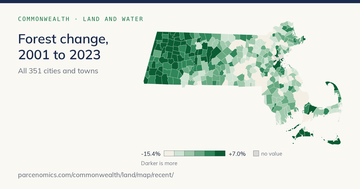
−96,285 acres
3,149,230 to 3,052,945 acres (−3.1%), forest and woody wetland. USGS Annual NLCD, one method.
Tree cover lost since 2001
163,379 acres
4.2% of the 3.88 million acres of tree cover in 2000, through 2025. Satellite record (Hansen/UMD); includes harvest, storms and clearing, and regrowth is not netted out. The map runs to 2024.
Core habitat, share of land
30%
1,517,377 acres of BioMap core habitat on 4,992,615 acres of land. MassGIS, NHESP.
Every figure is the sum of the 351 town figures behind the Land pages; sources are on each tile and in the notes below.
What the state’s forest is made of
OakHemlockBeechMapleBirchPineChestnutSpruce and firHickory, ash and other
Today, the five most common groups of trees are maple (27%): boxelder, norway maple, red maple, silver maple, striped maple, sugar maple; oak (19%): black oak, bur oak, chestnut oak, chinkapin oak, northern red oak, pin oak; pine (17%): eastern white pine, pitch pine, red pine; hemlock (13%): eastern hemlock; birch (11%): black birch, gray birch, paper birch, yellow birch. Each group’s species in this guide are linked.
Before settlement: surveyors’ lot-corner trees compiled by Harvard Forest (Cogbill, Burk and Motzkin, 2002). Today: U.S. Forest Service inventory plots (Thompson and others, 2013), pooled by county and weighted here by each county’s 2021 forest acres. The mix is by group of trees, not by species.
Most and least wooded
Most wooded, 2021
- Mount Washington99%
- Shutesbury97%
- Monroe97%
- Pelham97%
- Wendell96%
Least wooded, 2021
- Chelseaunder 1%
- Everettunder 1%
- Somervilleunder 1%
- Winthropunder 1%
- Watertownunder 1%
Most tree cover lost since 2001
- Plymouth4,987 acres
- Winchendon2,999 acres
- Ashburnham2,525 acres
- Royalston2,179 acres
- Belchertown2,055 acres
Most forest gained, 2001 to 2023
- West Tisbury+559 acres
- Nantucket+482 acres
- Chilmark+416 acres
- Edgartown+332 acres
- Gosnold+259 acres
Share of each town’s land that is forest on the DCR 2021 satellite map. Acres lost and gained are on different satellite records and cannot be netted against each other. Forest gained is net, forest and woody wetland, USGS Annual NLCD.
Where the forest grew and shrank
The inventory
What the Forest Service’s plots show
The U.S. Forest Service measures a grid of plots across the state. Its 2025 evaluation (plots measured 2019 to 2025) puts Massachusetts at 2.95 million acres of forest, 59% of the land, holding 1.33 billion live trees an inch or more across, 510 million of them five inches or more, and 9.3 billion cubic feet of wood in those larger trees. The forest adds about 148 million cubic feet of net growth a year while 109 million cubic feet dies, so mortality is about three-quarters of net growth. Stands are old for New England: 15% of forest land is over 100 years old, 47% is 81 to 100, and under 4% is under 40.
Forest land since 1985
Who owns the forest
Private 64% · 1,882,827 acresState 19% · 571,894 acresCounty and municipal 14% · 418,781 acresFederal 3% · 79,211 acres
Sampling error on the share: private 2.9%, state 6.7%, county and municipal 10.3%, federal 24.7% (of each estimate). FIA does not split county from municipal land; “federal” is National Park Service, Fish and Wildlife Service, Defense and other, each from a handful of plots.
The most common trees
Share of live trees (an inch or more across)
- Red Maple20.2%
- Eastern White Pine12.3%
- Eastern Hemlock11.4%
- American Beech10.8%
- Black Birch7.6%
- Sugar Maple4.7%
- Northern Red Oak4.0%
- Yellow Birch3.9%
- Black Cherry2.0%
- White Ash1.9%
- Black Oak1.7%
- Striped Maple1.7%
Share of wood volume (trees five inches or more)
- Eastern White Pine29.5%
- Red Maple15.7%
- Northern Red Oak11.4%
- Eastern Hemlock9.4%
- Sugar Maple4.4%
- Black Birch3.7%
- Black Oak3.6%
- White Ash2.7%
- Scarlet Oak2.7%
- White Oak2.6%
- Yellow Birch2.2%
- Black Cherry2.0%
Red maple is one tree in five but its volume is about 16%; white pine is about 12% of trees and nearly 30% of the wood. Hover a percentage for its sampling error.
Source. USDA Forest Service, Forest Inventory and Analysis, Massachusetts evaluation 2025 (plots measured 2019–2025); sampling errors in the data notes.
Data notes
Show
Every figure is an estimate from sample plots. Sampling error (SE) is given as a percent of the estimate.
- Forest land 2,952,712 acres (SE 1.7%). Forest share of land 59.4% (forest and non-forest land; water excluded); the share’s own error is about the same as the area’s, 2%.
- Live trees an inch or more across (saplings included): 1,333 million (SE 3.4%). Five inches or more: 510 million (SE 2.3%).
- Volume is net merchantable bole wood of live timber-species trees five inches or more across: 9.31 billion cubic feet (SE 2.8%). Growing-stock volume, a narrower basis, is 8.44 billion (SE 3.0%). Woodland species (hawthorn, scrub oak, serviceberry and others) have no volume.
- Growth and mortality come from the remeasurement evaluation (the same plots measured in 2012–2018 and again in 2019–2025) and use sound bole wood volume, a slightly larger basis than the standing volume above. Net growth 148 million cubic feet a year (SE 7.4%); mortality 109 million (SE 7.2%). Mortality is 74% of net growth. Neither figure separates causes such as hemlock adelgid, beech disease or emerald ash borer.
- Stand age: over 100 years 15% of forest land (SE 11%); 81 to 100 years 47%; under 40 years 3.7% (SE 20% to 55% by class). Classes above 130 years rest on one or two plots and are not quoted.
- Species shares are reliable for about the top ten (SE 8% to 18%); rank order below that is not. Of 70 species with live trees, 51 have an SE above 30%, so the guide gives a share only where the SE is 30% or less. Red pine, flowering dogwood and pin oak were not found among live trees in the current sample; that is a sampling result, not proof they are gone. Hawthorns, apples, willows and the two shadbushes are given as genus figures.
- Ownership: private 63.8% (SE 2.9%), state 19.4% (6.7%), county and municipal 14.2% (10.3%), federal 2.7% (24.7%). Reserved (legally set aside) land is 4.0% (SE 20.6%).
- Forest area through time: the 1985 and 1998 inventories were periodic surveys with a different plot design; 2005 rests on only three annual panels (SE 3.5%).
Old growth
Show
D’Amato, Orwig and Foster (2006) found 1,119 acres (452.8 hectares) of old-growth forest on Massachusetts state land, in 33 stands: Mohawk Trail, Monroe, Savoy Mountain and Windsor state forests, Mount Greylock, Mount Washington, Mount Everett, Beartown, East Mountain and Wachusett Mountain. No inventory exists for old growth on private or municipal land.
| No. | Stand | State land | Hectares | Town |
|---|---|---|---|---|
| 1 | Cold River: Route 2 to MT Black Brook | Mohawk Trail State Forest | 38.4 | Savoy * |
| 2 | Cold River: Route 2 to MT Black Brook Picnic Area | Mohawk Trail State Forest | 14.2 | Savoy * |
| 3 | Lower Gulf Brook | Mohawk Trail State Forest | 6.1 | Savoy * |
| 4 | Manning Brook | Mohawk Trail State Forest | 6.1 | Florida * |
| 5 | Black Brook | Mohawk Trail State Forest | 10.1 | Savoy * |
| 6 | Tannery Falls | Mohawk Trail State Forest | 3.6 | Savoy |
| 7 | Todd and Clark Mountains | Mohawk Trail State Forest | 80.9 | Charlemont * |
| 8 | Trout Brook West | Mohawk Trail State Forest | 6.1 | Charlemont * |
| 9 | Hawks Mountain | Mohawk Trail State Forest | 2 | Charlemont * |
| 10 | Thumper Mountain | Mohawk Trail State Forest | 0.8 | Charlemont |
| 11 | Middle Cold River to Route 2 | Mohawk Trail State Forest / Savoy Mountain State Forest | 18.2 | Florida * |
| 12 | Upper Cold River | Mohawk Trail State Forest / Savoy Mountain State Forest | 32.4 | Florida * |
| 13 | Upper Gulf Brook | Mohawk Trail State Forest / Savoy Mountain State Forest | 8.1 | Savoy |
| 14 | Bear Swamp | Monroe State Forest | 12.1 | Florida * |
| 15 | Dunbar Brook | Monroe State Forest | 8.1 | Monroe * |
| 16 | Parsonage Brook | Monroe State Forest | 1.6 | Monroe |
| 17 | Spruce Mountain | Monroe State Forest | 1.6 | Monroe |
| 18 | Smith Brook-Deerfield River | Monroe State Forest | 1.6 | Florida * |
| 19 | Hunt Hill | Monroe State Forest | 2.8 | Florida * |
| 20 | Windsor Jambs | Windsor State Forest | 1.2 | Windsor |
| 21 | The Hopper | Mount Greylock State Reservation | 46.5 | Adams * |
| 22 | Stony Ledge | Mount Greylock State Reservation | 4 | Williamstown |
| 23 | Mount Williams | Mount Greylock State Reservation | 10.1 | North Adams * |
| 24 | Roaring Brook | Mount Greylock State Reservation | 10.1 | New Ashford * |
| 25 | Bash Bish Falls | Mount Washington State Forest | 15.4 | Mount Washington * |
| 26 | Mount Race | Mount Washington State Forest | 2 | Mount Washington * |
| 27 | Sages Ravine-Bear Rock Falls | Mount Washington State Forest | 4.9 | Sheffield * |
| 28 | Alander Mountain | Mount Washington State Forest | 2 | Mount Washington |
| 29 | Mount Everett-Glen Brook | Mount Everett State Reservation | 14.2 | Mount Washington * |
| 30 | Mount Everett-Guilder Pond | Mount Everett State Reservation | 1.6 | Mount Washington |
| 31 | Burgoyne Pass | Beartown State Forest | 1.2 | Lee * |
| 32 | Ice Gulch | East Mountain State Forest | 3.6 | Sheffield * |
| 33 | Wachusett Mountain | Wachusett Mountain State Reservation | 80.9 | Princeton |
The paper’s table gives no town. We placed each stand’s printed latitude and longitude inside the town boundaries, so the town is derived, not stated; stands marked * lie within a few hundred metres of a town line and may straddle it. Stand 33 (Wachusett Mountain) is printed in the table with the Mount Washington code; we read it as Wachusett. The areas as read here sum to 452.5 hectares against the paper’s printed 452.8; the 0.3-hectare gap is unresolved. 1 hectare = 2.471 acres.
D’Amato, A.W., D.A. Orwig and D.R. Foster. 2006. New estimates of Massachusetts old-growth forests: useful data for regional conservation and forest reserve planning. Northeastern Naturalist 13(4): 495–506, Table 1. PDF.
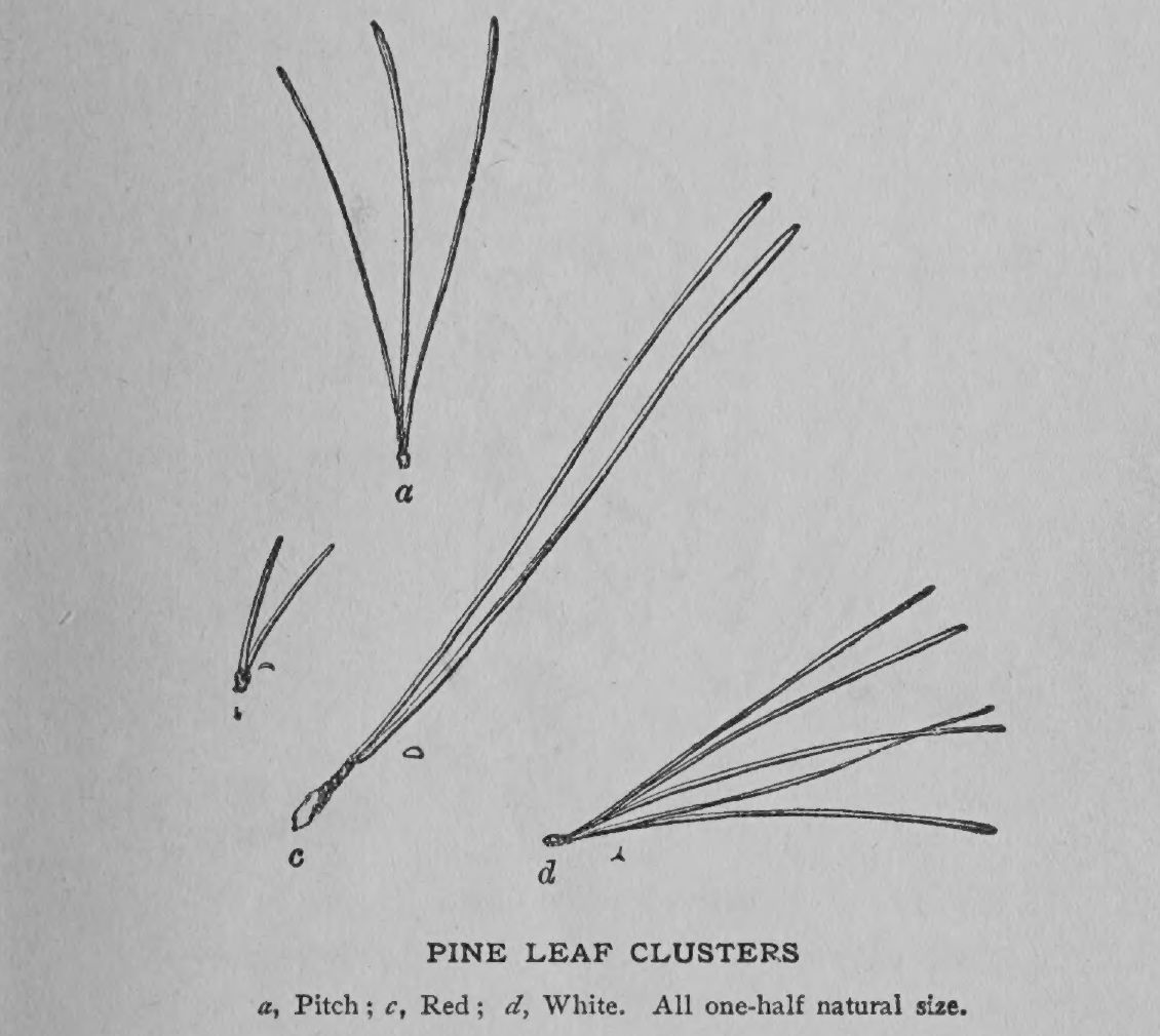
Opposite leaves (and buds) in our woods mean maple, ash, dogwood, viburnum or horse-chestnut — the old mnemonic is MAD Horse. Everything else is alternate. Needles in bundles of five: white pine; two: red pine; three: pitch pine.
From the 1925 manual
How to know the pines, spruces, oaks, maples and the rest
The 1925 foresters wrote one table per genus: the two or three features that tell its species apart in the field. They still work.
How to know the Pines
Show
| Tree | Leaves |
|---|---|
| White Pine Pinus strobus L. | Arranged in 5-leaved clusters. Slender, flexible, bluish-green and 3 to 5 inches long. |
| Red Pine (Norway Pine) Pinus resinosa Ait. | Arranged in 2-leaved clusters. Flexible, dark green and 5 to 6 inches long. |
| Pitch Pine Pinus rigida Mill. | Arranged in 3-leaved clusters. Stiff, dark yellow-green and 3 to 5 inches long. |
Note.— The Austrian and Scotch Pines are sometimes planted in Massachusetts. Both are introduced or imported. The Scotch Pine has two leaves in a cluster, two to four inches long, flat and of a bluish-white hue. The Austrian has dark green, slender, rigid leaves, two in a cluster, four to six inches long.
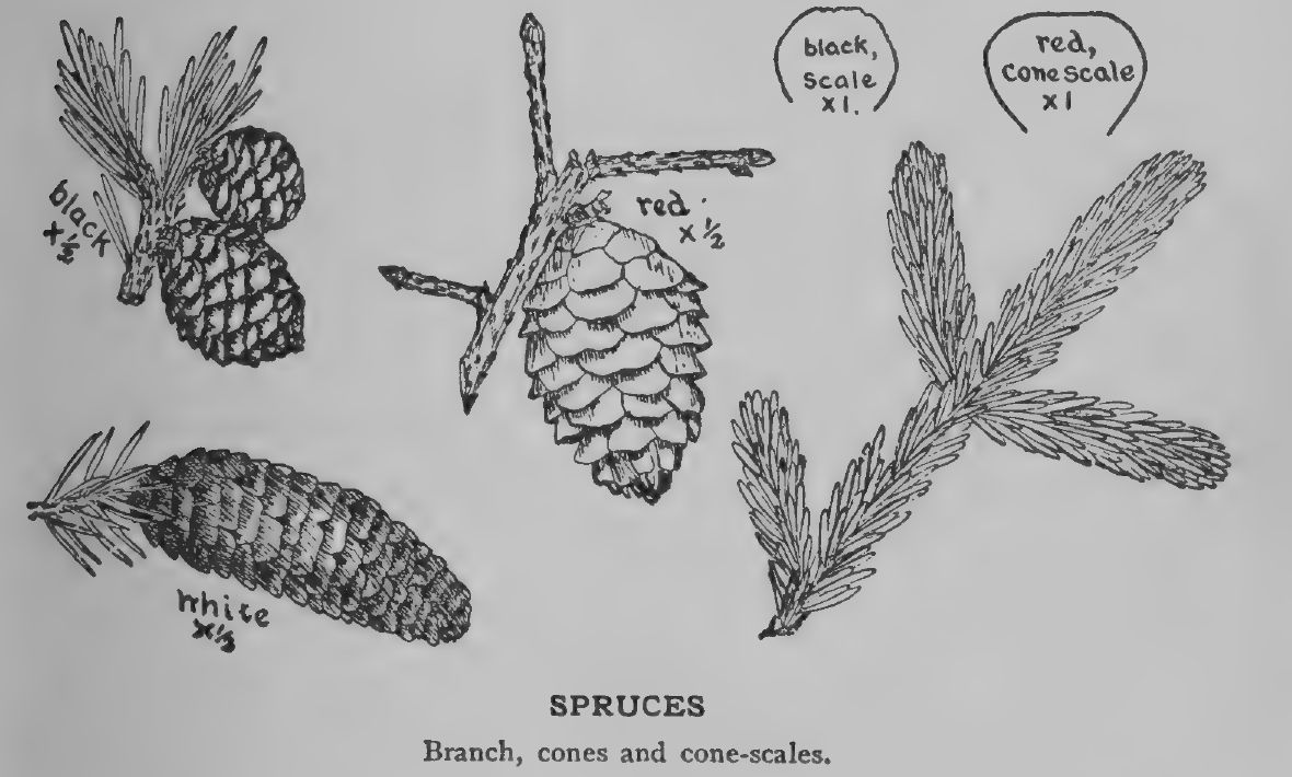
How to know the Spruces
Show
| Tree | Cones | Leaves |
|---|---|---|
| Black Spruce Picea mariana B. S. P. | One-half to one and a half inches in length. Usually remain on the tree for many years. | Blue-green and not glossy. |
| Red Spruce Picea rubens Sarg. | One to two inches in length. Usually fall during the first year. | Dark yellow-green and very glossy. |
Note.— The Norway Spruce, so commonly planted as an ornamental tree and for hedges, is an introduced species. It has a large, slender cone, five to seven inches long, which easily distinguishes it from others. The branches are also more drooping or pendulous.
How to know the Walnuts
Show
| Tree | Bark_On_Trunk | Fruit | Habit | Leaves |
|---|---|---|---|---|
| Butternut Juglans cinerea L. | Dark gray and divided into broad, flat ridges. | Oblong, cylindrical and covered with sticky hairs. | Low, wide-branching, with a broad, round-topped head. | Leaflets 11 to 17 in number. |
| Black Walnut Juglans nigra L. | Dark brown or almost black and deeply divided into rounded ridges which cross each other obliquely. | Globular, without sticky hairs, and somewhat rough. | Tall, straight, destitute of branches for a considerable distance from the ground, with a narrow, round-topped head. | Leaflets 15 to 23 in number. |
The Black Walnut and Butternut are easily cultivated, being grown readily by planting the nuts where they are to remain. Seedlings can also be transplanted, but care must be exercised, as they have a pronounced tap-root. The Black Walnut makes a valuable forest tree, and both species make good shade trees and are also valuable for their nuts.
* The true Walnuts. New England people use this name commonly for the Hickories. (See Hickories.)
How to know the Hickories
Show
| Tree | Bark_On_Trunk | Fruit | Leaves | Twigs | Winter_Buds |
|---|---|---|---|---|---|
| Bitternut Hicoria minima Britton | Less rough than in the other species. Light granite-gray tinged with faint yellow and broken into thin, plate-like scales. | Husk thin. Nut thin-shelled and kernel bitter. | Leaflets 7 to 11 in number. | Smooth. | Covered with two pairs of scales and bright yellow. |
| Shagbark Hicoria ovata Britton | Rougher than in other species. Light gray and separates into long, thick plates which are only slightly attached to the tree. | Husk thick and deeply channeled at the seams. Shell usually thick and the kernel sweet. | Leaflets usually 5, rarely 7. | Smooth or coated with soft hairs. | Terminal bud egg-shaped. Outer scales are dark reddish-brown with long, narrow tips and persist until spring. |
| Mocker Nut Hicoria alba Britton | Dark gray, with numerous ridges and without flaking plates. | Husk thick and strong-scented. The shell thick and the kernel small and sweet. | Leaflets 7 or 9 in number. | Stout and covered with a woolly growth. | Terminal buds broadly egg-shaped. Outer scales are dark reddish-brown and fall in autumn. Inner scales light green. |
| Pignut Hicoria glabra Britton | Dark gray. Comparatively smooth. Often broken into plates. | Husk usually thin. The shell either thick or thin and the kernel sweet or bitter. | Leaflets 3, 5 or 7, in number. | Smooth. | Terminal buds elliptical. Outer scales are dark reddish-brown and usually fall in the autumn. Inner scales yellow-green. |
How to know the Poplars
Show
| Tree | Bark | Leaves | Winter_Buds |
|---|---|---|---|
| Aspen (American) Populus tremuloides Michx. | Very bitter. | Roundish. Margin finely toothed. Upper surface lustrous. | Conical, lustrous and somewhat sticky. |
| Largetooth Aspen Populus grandidentata Michx. | Not bitter. | Broadly egg-shaped. Margin coarsely scalloped. Upper surface not lustrous. | Broadly egg-shaped. Not sticky and covered with whitish, matted hairs. |
Note.— Introduced species. In addition to these native Poplars, two European species are very commonly planted — the Lombardy Poplar (P. nigra italica), recognized by its tall, spire-like form, and the White Poplar (P. alba), easily distinguished by its leaves, green above and very white-cottony beneath.
The Poplars belong to the Willow family and resemble the Willows, especially in flower and fruit characters. The nodding, worm-like, staminate and pistillate catkins are borne upon different trees and, opening before the leaves, are conspicuous in early spring. The Poplars are quite widely distributed, extending from the Arctic circle to Mexico and from the Atlantic to the Pacific.
The wood of Poplars is very soft and light and especially liable to warp, but is cheap and useful for making toys, boxes and smaller furniture. Much of it now goes to the pulp mills.
The Poplars, like the Willows, can be propagated easily from cuttings.
How to know the Birches
Show
| Tree | Bark | Flowers | Leaves |
|---|---|---|---|
| Gray Birch Betula populifolia Marsh. | Grayish-white and chalky on the outer surface and orange on the inner. Does not separate into papery layers. | Winter catkins borne singly or in pairs. | Triangular, long-pointed and coarsely doubly toothed. Lustrous on upper surface. |
| Paper or White Birch Betula papyrifera Marsh. | Creamy-white and lustrous on the outer surface and orange on the inner. Separates readily into thin layers. | Winter catkins borne in clusters of three. | Egg-shaped and not long-pointed. Usually doubly toothed. Not lustrous. |
| Yellow Birch Betula lutea Michx. f. | Silvery-gray or light orange in color. Separates into thin, persistent layers. On young branches aromatic. | Winter catkins not clustered. Three to four on a shoot. | Egg-shaped to oblong. Sharply doubly toothed. |
| Sweet or Black Birch Betula lenta L. | Dark, almost black and without lustre. Broken into large, irregular plates. On young branches aromatic. | Winter catkins not clustered. Three to four on a shoot. | Egg-shaped to oblong. Sharply toothed. |
Note.— The European White Birch (B. alba), an introduced species, is commonly planted for ornamental purposes. It is a beautiful tree, closely resembling the native White Birch. There are numerous horticultural varieties, some with finely-cut leaves and pendulous branches.
The wood of Birches is valued chiefly for cabinet-making, for spools and other small articles.
Birches yield quantities of seed and are extremely valuable in reseeding waste and barren lands, and rendering the conditions favorable to White Pine coming in. The White Pine then replaces them in clean stands.
When young, the saplings of all the species look more or less alike.
How to know the Oaks
Show
| Tree | Bark | Fruit | Leaves | Winter_Buds |
|---|---|---|---|---|
| White Oak Quercus alba L. | Light ashen-gray and broken into thin, irregular flakes. | Matures first year. | With rounded lobes. | Broadly egg-shaped, acute or obtuse at apex, and red-brown. |
| Chestnut Oak Quercus prinus L. | Dark brown or almost black and divided into broad, rounded ridges. | Matures first year. | Not lobed but coarsely and irregularly scalloped. | Egg-shaped, rather long-pointed and chestnut-brown. |
| Swamp White Oak Quercus platanoides Sud. | Grayish-brown and deeply and irregularly divided into broad, flat ridges. | Matures first year. | Scalloped or slightly lobed. | Roundish, obtuse at apex, and brown. |
| Red Oak Quercus rubra L. | Dark gray or almost black and coarsely and irregularly ridged, yet never extremely rough. Inner bark reddish. | Matures second year. | Lobes with sharp tips. Upper surface without lustre. | Conical, reddish-brown and smooth. |
| Scarlet Oak Quercus coccinea Muenchh | Dark gray and broken into small, irregular ridges. Inner bark reddish. | Matures second year. | Lobes with sharp tips. Upper surface lustrous. | Small, reddish-brown and smooth. |
| Yellow Oak Quercus velutina Lam. | Dark, almost black, and deeply divided into broad, rounded ridges. Inner bark often yellow. | Matures second year. | Lobes with sharp tips. Upper surface lustrous. | Large, strongly angled and coated with matted wool. |
How to know the Elms
Show
| Tree | Bark_On_Trunk | Habit | Leaves | Winter_Buds |
|---|---|---|---|---|
| Slippery Elm Ulmus pubescens Walt. | Dark brown tinged with red. Inner bark mucilaginous. | Medium height. Head broad and almost flat. | Very rough on the upper surface and nearly as rough on the lower. | Dark brown and covered with rusty hairs. |
| White or American Elm Ulmus americana L. | Ashy-gray. Inner bark not mucilaginous. | Tall and variable in outline, yet typically vase-shape. | Somewhat rough on the upper surface and smooth on the lower. | Brown and smooth. |
How to know the Maples
Show
| Tree | Bark_On_Trunk | Flowers | Habit | Leaves |
|---|---|---|---|---|
| Striped Maple Acer pennsylvanicum L. | Reddish-brown or dark green with whitish longitudinal striations. | Bright yellow, in slender racemes. Appear when leaves are fully developed. | A shrub or small, erect tree. Trunk continuous. | Roundish, 3-lobed and finely and sharply doubly toothed. |
| Sugar Maple (Rock Maple) Acer saccharum Marsh. | Gray in color. On old trunk, rough with long ascending scales which project irregularly at the edges. | Greenish-yellow, in clusters, on long, threadlike stalks. Appear with the leaves. | When young the outline is usually narrowly egg-shaped. Later it may become roundish. Trunk continuous. | Usually 5 lobes, sometimes 3. Bays between lobes rounded. Lobes sparingly toothed. |
| Silver Maple Acer saccharinum L. | Dark gray with a reddish tinge. More or less furrowed. Separates into thin scales. | Greenish-yellow or pinkish, in clusters. Appear long before the leaves. | Normally, trunk separates at a few feet from ground into three or four upright stems. Branches slender and often pendulous. | Usually 5 lobes, rarely 3. Lobes long, narrow and toothed. Silvery white on under-surface. |
| Red Maple Acer rubrum L. | Dark gray. Marked by longitudinal ridges and broken into plate-like scales. | Scarlet or yellowish-red, in clusters. Appear before the leaves. | Trunk upright and usually continuous. Occasionally it divides into 2 or 3 upright stems. Head narrow and roundish. | Lobes 3 to 5. Lobes broad and irregularly doubly serrate or toothed. White on under-surface. |
How to know the Ashes
Show
| Tree | Leaves | Winter_Buds_And_Twigs |
|---|---|---|
| Black Ash Fraxinus nigra Marsh. | Leaflets 7 to 11 and without stalks, excepting the terminal one. | Buds black. Shoots olive-green, smooth. |
| White Ash Fraxinus americana L. | Leaflets 7 to 9 and supported by short stalks. | Buds brown. Shoots olive-green, smooth and lustrous. |
| Red Ash Fraxinus pennsylvanica Marsh. | Leaflets 7 to 9 and supported by short stalks. | Buds brown. Shoots greenish and more or less covered with down. |
From the 2016 manual
The forest types of Massachusetts
Forest Types of Massachusetts
Show
In spite of being one of the smallest of the 50 states, Massachusetts is endowed with a particularly diverse cross-section of forest types. From the Cape to the Berkshires, the variability in climate, latitude, elevation, soils, bedrock, and land use patterns has created a complex and continually changing mosaic of woodlands, each patch of woods bearing testament to centuries of change and hinting at how it might change in the future.
The trees themselves are the first clue to understanding the stories contained in the woods, and with this modern incarnation of a historical booklet, we hope to provide a useful and usable primer to the trees in our forests to enrich the experiences of another generation of Massachusetts citizens and visitors.
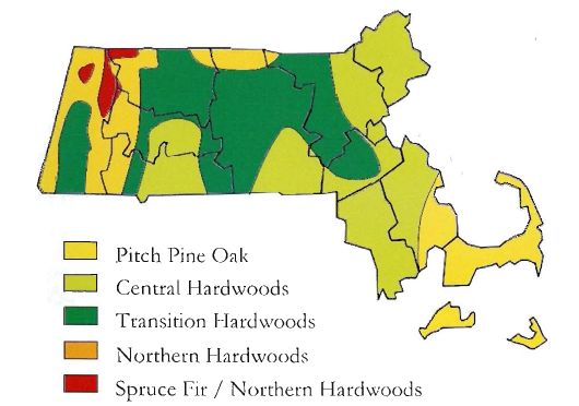
While forest types actually occur across a continuum, it is useful to break the landscape up into regions where certain types are more common. The figure below depicts a common delineation of these regions, such as is used by natural resource professionals, and brief descriptions of each appear below. Thinking about the woods according to these regions is a first step, but remember that the diversity and heterogeneity of our woodlands means that any given acre of forestland in Massachusetts is capable of holding oddities, surprises or mysteries that even make the professionals scratch their heads!
Pitch Pine-Oak
Show
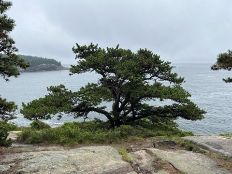
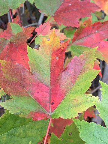
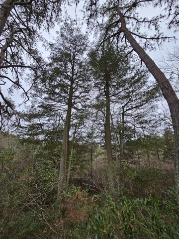
If you are among the millions of visitors to Cape Cod in a given year, you have likely been immersed in this forest type. The dominant trees are Pitch Pine and Red, White, Black, and Scarlet Oaks. Shrubs commonly occur in the understory, including Scrub Oak and Huckleberry.
Fire, both wildfire and human-caused, has played a dominant role in creating and perpetuating this forest type, and considerable effort is presently underway to restore fire in a controlled manner to achieve both ecological and fire hazard reduction objectives.
Forested wetlands are common and are typically dominated by Red Maple and Atlantic White Cedar. Though highly fragmented by development, large intact examples of this forest type exist with public access at Cape Cod National Seashore and Myles Standish State Forest, among others.
Central Hardwoods
Show
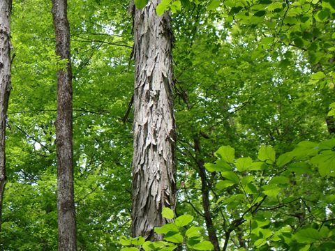
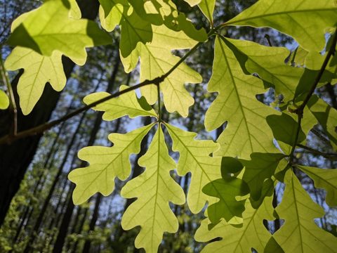
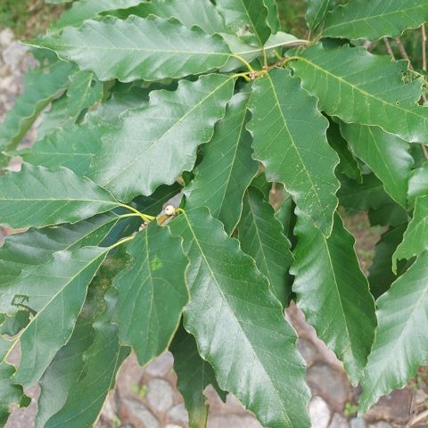
This is a more southern forest type that creeps up into the warmer areas of the state. Also known as the “Oak-Hickory” type, common forest trees include Hickories (Shagbark, Pignut, and Mockernut), Oaks (Red, Black, Scarlet, White, and Chestnut), Red Maple, Hemlock, and White Pine.
Historically, American Chestnut was an appreciable component, and Chestnut sprouts are still commonly encountered. Being typical of warmer sites, this forest type can also be found on sunny south-facing slopes within the Transition Hardwoods zone.
A central hardwoods forest in fall, Mt. Toby, Sunderland.
Northern Hardwoods
Show
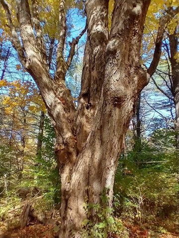
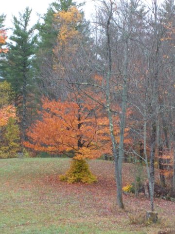
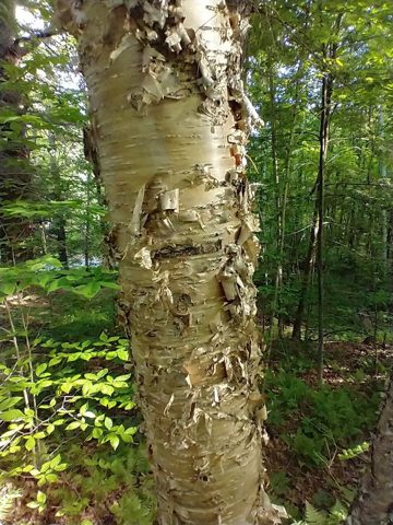
A number of tree species found in the Transition Hardwoods region taper off at the higher elevations and latitudes of western Massachusetts, creating a true Northern Hardwoods type. The characteristic species are Sugar Maple, American Beech, Yellow Birch and White Ash, though Red Maple and Red Oak commonly co-occur.
Conifers may be nearly absent over large areas, but when present will include Hemlock, Red Spruce and Balsam Fir (especially in wetlands).
On richer sites (i.e. richer in nutrients), which incidentally are more common west of the Connecticut River, White Ash and Sugar Maple will be more dominant in the mixture, and both Basswood and Bitternut Hickory enter in as well. These “rich woods” often harbor a multitude of rare and interesting plants, including the early-blooming “spring ephemerals” that follow shortly after the snowmelt.
Spruce-Fir / Northern Hardwoods
Show
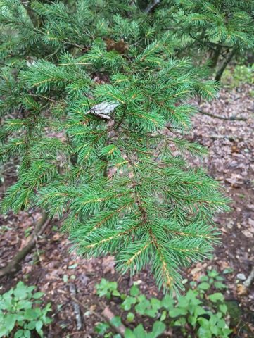
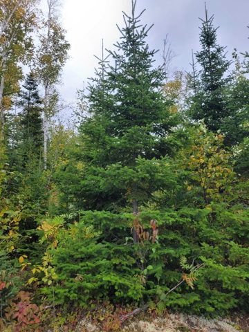
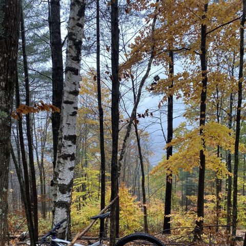
This type is restricted to the northern half of Berkshire County, which contains the highest elevations in the Commonwealth, namely Mount Greylock and the northwestern extremity of the Berkshire Plateau.
Red Spruce and Balsam Fir are locally prevalent, with Tamarack and American Mountain-Ash often found in association. More often these are mixed with Yellow Birch, Paper Birch, American Beech, Red Maple, and Sugar Maple.
The epitome of this type may be found on the summit of Mount Greylock. At an elevation of 3,491 ft., Greylock attains a true “subalpine climate”, such as you might see on a hike in the White Mountains, with Balsam Fir, Red Spruce, and Showy Mountain-Ash becoming dominant.
Transition Hardwoods
Show
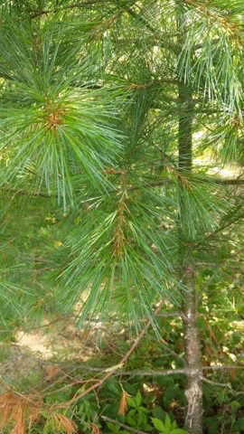
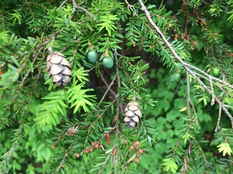
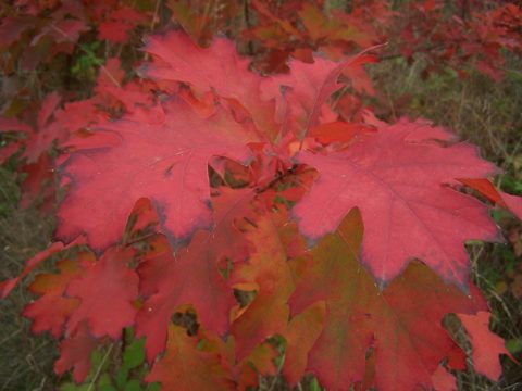
This highly variable zone is a living testament to the “tug of war” that has taken place between the Northern Hardwoods and Central Hardwoods over the last several millennia.
Fluctuations in climate, fire regimes and logging intensity, as well as changes in land use and management objectives, have effectively blurred the line between the northern and southern forest type, creating a region of heterogeneity that is typified by a large number of tree species.
The most common mixture of trees includes Red Oak, White Pine, Red Maple, Black Birch, and Hemlock, but any of the species from the northern or southern types may co-occur with these, and pockets of pure northern or southern associations are likely across the landscape.
Floodplain Forest
Show
Though not mapped in the figure, the floodplains of our major rivers, like the Connecticut and Merrimack, still harbor a special forest type that has furnished a number of familiar street trees.
Floodplain trees, by nature, are tolerant of restricted root zones, high water tables, and other stresses that make them good candidates for planting in the urban and suburban landscape.
American Elm was perhaps the first and most successful floodplain tree to enter the landscape trade, though its prevalence was curtailed by Dutch Elm Disease. Other trees you may be familiar with include Green Ash, Sycamore, Silver Maple, River Birch (Merrimack River only), and Cottonwood.
About this guide
Two state manuals, ninety-one years apart
In 1925 the Department of Conservation printed The Commercial Forest Trees of Massachusetts: 48 trees, drawn by hand, with a key for each genus. In 2016 the Department of Conservation and Recreation printed the seventh edition of Forest Trees of Massachusetts: 83 trees, with county maps. This guide puts the two side by side for every tree that appears in both, adds what the forest record says about each group of trees since settlement, and what the aerial survey has mapped attacking it. Every town’s own forest — acres, mix, change since 1830 — is on its habitat, forest and water page.
Where the pictures come from
Show
Photographs. 83 of 83 trees carry a photograph from iNaturalist, a research-grade observation (identification confirmed by the community) shared by its photographer under a Creative Commons licence. Each is listed here with the photographer and a link to the observation. Photographs are cropped to fit; nothing else is altered.
CC0 (59)
- American Basswood — Tys Theijsmeijer · observation
- American Holly — Sterling Herron · observation
- American Mountain-Ash — Lynn Harper · observation
- Atlantic White Cedar — Daniel Atha · observation
- Balsam Fir — Denise Alano · observation
- Bigtooth Aspen — Lynn Harper · observation
- Bitternut Hickory — Étienne Lacroix-Carignan · observation
- Black Birch — Lynn Harper · observation
- Black Cherry — Brighton Lee · observation
- Black Spruce — Lynn Harper · observation
- Black Walnut — the permian extinction · observation
- Boxelder — the permian extinction · observation
- Bur Oak — Vince Hale · observation
- Butternut — Jeffrey Mcdavitt · observation
- Chestnut Oak — the permian extinction · observation
- Chinkapin Oak — Reuven Martin · observation
- Crabapple — Jeffrey Mcdavitt · observation · Malus domestica
- Eastern Cottonwood — Lynn Harper · observation
- Eastern Hophornbeam — Lynn Harper · observation
- Eastern Red Cedar — Vince Hale · observation
- Eastern White Pine — Mark Connolly · observation
- European Buckthorn — Lynn Harper · observation
- European Mountain-Ash — Wendy A · observation
- Flowering Dogwood — Austin Pursley · observation
- Glossy Buckthorn — Wren L. · observation
- Gray Birch — John Dziak · observation
- Green Ash — andrew2285 · observation
- Hackberry — Erik Schiff · observation
- Hawthorn — Geoff Swaebe · observation · Crataegus monogyna
- Honey Locust — d33j · observation
- Hornbeam — John Kees · observation
- Littleleaf Linden — Conway Hawn · observation
- London Planetree — Kian Hayles-Cotton · observation
- Northern Red Oak — Joseph Savage · observation
- Norway Maple — Lynn Harper · observation
- Norway Spruce — Lynn Harper · observation
- Paper Birch — Kent P. McFarland · observation
- Pignut Hickory — andrew2285 · observation
- Pin Cherry — Lynn Harper · observation
- Pitch Pine — zx3lvta7us · observation
- Post Oak — Niyan Shehan · observation
- Quaking Aspen — Lynn Harper · observation
- Red Pine — Tys Theijsmeijer · observation
- Red Spruce — Daniel Estabrooks · observation
- Sassafras — Alan Weakley · observation
- Scarlet Oak — Lynn Harper · observation
- Scrub Oak — Yann Kemper · observation
- Shagbark Hickory — Lynn Harper · observation
- Silver Maple — suzannehale · observation
- Smooth Shadbush — Étienne Lacroix-Carignan · observation
- Speckled Alder — natgrace18 · observation
- Staghorn Sumac — Lynn Harper · observation
- Swamp White Oak — Reuven Martin · observation
- Tamarack — Carter Dorscht · observation
- Tree of Heaven — Daniel Atha · observation
- White Ash — Raven Dandridge · observation
- White Oak — Austin Pursley · observation
- Willows — Jacob Mullin · observation · Salix nigra
- Witchhazel — Lynn Harper · observation
CC BY (23)
- Alternate-Leaf Dogwood — Nathan Aaron · observation
- American Beech — Tom Norton · observation
- American Chestnut — Lucian Vazquez · observation
- American Elm — Tom Norton · observation
- Amur Corktree — chrischalfant · observation
- Black Ash — Tom Norton · observation
- Black Locust — Tom Scavo · observation
- Black Oak — Sandy Wolkenberg · observation
- Black Tupelo — naturalist charlie · observation
- Downy Shadbush — Dominic · observation
- Eastern Hemlock — Ian Manning · observation
- Mockernut Hickory — Daniel McClosky · observation
- Northern Catalpa — Skyler Principe · observation
- Northern White Cedar — Tom Norton · observation
- Pin Oak — Bruce Slater · observation
- Red Maple — Sandy Wolkenberg · observation
- Showy Mountain-Ash — Jason Hill · observation
- Striped Maple — Marco Mussita · observation
- Sugar Maple — Tom Norton · observation
- Sycamore — Tom Norton · observation
- White Spruce — Heather Mazzaccaro · observation
- Yellow Birch — Tom Norton · observation
- Yellow-Poplar — Michael J. Papay · observation
CC BY-NC (1)
- Slippery Elm — Charley Eiseman · observation
Drawings. The line drawings are from The Commercial Forest Trees of Massachusetts (1925), Massachusetts Department of Conservation, Division of Forestry, and from Forest Trees of Massachusetts, 7th edition (2016), Department of Conservation and Recreation.
Text and line illustrations: Forest Trees of Massachusetts, 7th edition (2016), Massachusetts Department of Conservation and Recreation, Bureau of Forest Fire Control and Forestry, funded by the USDA Forest Service. Drawings, 1925 descriptions and the “How to know” keys: The Commercial Forest Trees of Massachusetts (1925), Massachusetts Department of Conservation, Division of Forestry. Forest shares before settlement and today: Harvard Forest data archive (Cogbill, Burk and Motzkin 2002; Thompson and others 2013). Insects and disease: USDA Forest Service Insect and Disease Survey, Region 9, with DCR. Photographs: observations on iNaturalist (inaturalist.org), each credited to its photographer under its Creative Commons licence; the list is under “Where the pictures come from” on the guide page. Species ranges by county are as the 2016 manual maps them. Transcribed by script and proofread in part; the manuals govern where they differ.