Bur Oak
Leaves alternate, lobed · Family Fagaceae · Also called Mossycup Oak
In the inventory · Live trees fewer than 1 in 100 · Volume under 1% · Growth and mortality too few to estimate. USDA Forest Service, Forest Inventory and Analysis, 2019–2025; live trees an inch or more across, volume of trees five inches or more. Shares quoted only where the sampling error is 30% or less.
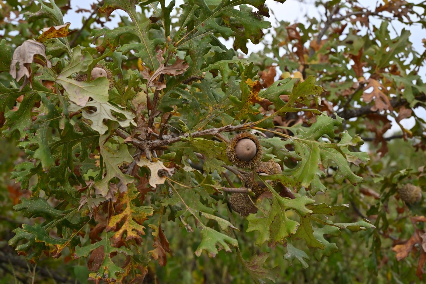
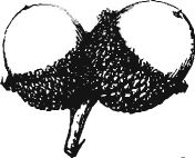
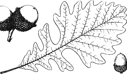
What to look for
BUR Oak is a rare and graceful tree of certain less-acidic forests of western Massachusetts. It is associated in particular with the Housatonic River watershed, where the limestone influence on the groundwater and the loamier soils are more similar to its preferred Midwestern habitats. It is much more common in the prairie-forest transition states (e.g. Illinois, Wisconsin, and others) where it is uniquely adapted to the stressors of heavy soils, cycles of drought and frequent fire (historically).
It is typically a large and impressive tree, upwards of eighty feet in height. Growing in the woods, it is notable for its distinctly ascending branches, though when grown in the open it readily attains a broad spreading form, making it a fitting park tree.
The bark is dark brown or gray, coarse, rough, and blocky. Twigs are often exceptionally corky.
The simple leaves are oblong and strongly lobed, arranged alternately along the stem, and distinguished from similar trees by the pair of very deep sinuses at the midpoint of the leaf which nearly cut to the midvein.
The fruit is an enormous acorn, up to two inches in diameter, deeply embedded within a warty fringed cap.
Where it grows
Mapped in 2 of fourteen counties: Berkshire, Hampshire.
In the forest record
Trees of this group (oak) were 45% of the trees surveyors recorded at lot corners before settlement and are 19% of trees on inventory plots today, statewide.
Each town’s own numbers are on its habitat, forest and water page.
The oak group is among the three most common kinds of tree in the surveyors’ record of 127 of the 164 towns with a surviving record, and the largest share of that record is in Boxford (81%), Natick (80%), Newton (77%). The record is by group of trees, not by species, and covers towns with at least 50 recorded trees for the “largest share” list.
Insects and disease on the record
| Agent | Years seen | Worst year | Acres that year | Last seen |
|---|---|---|---|---|
| Spongy moth | 21 | 2017 | 1,049,099 | 2025 |
| Forest tent caterpillar | 11 | 2006 | 362,694 | 2018 |
| Winter moth | 13 | 2011 | 88,793 | 2018 |
Acres are of mapped damage, which can include other trees and non-forest; some agents attack several hosts.
Text and line illustrations: Forest Trees of Massachusetts, 7th edition (2016), Massachusetts Department of Conservation and Recreation, Bureau of Forest Fire Control and Forestry, funded by the USDA Forest Service. Drawings, 1925 descriptions and the “How to know” keys: The Commercial Forest Trees of Massachusetts (1925), Massachusetts Department of Conservation, Division of Forestry. Forest shares before settlement and today: Harvard Forest data archive (Cogbill, Burk and Motzkin 2002; Thompson and others 2013). Insects and disease: USDA Forest Service Insect and Disease Survey, Region 9, with DCR. Photographs: observations on iNaturalist (inaturalist.org), each credited to its photographer under its Creative Commons licence; the list is under “Where the pictures come from” on the guide page. Species ranges by county are as the 2016 manual maps them. Transcribed by script and proofread in part; the manuals govern where they differ.