Boxelder
Leaves opposite, compound · Family Aceraceae · Also called Ashleaf Maple
In the inventory · Live trees fewer than 1 in 100 · Volume under 1% · Growth and mortality too few to estimate. USDA Forest Service, Forest Inventory and Analysis, 2019–2025; live trees an inch or more across, volume of trees five inches or more. Shares quoted only where the sampling error is 30% or less.
What to look for
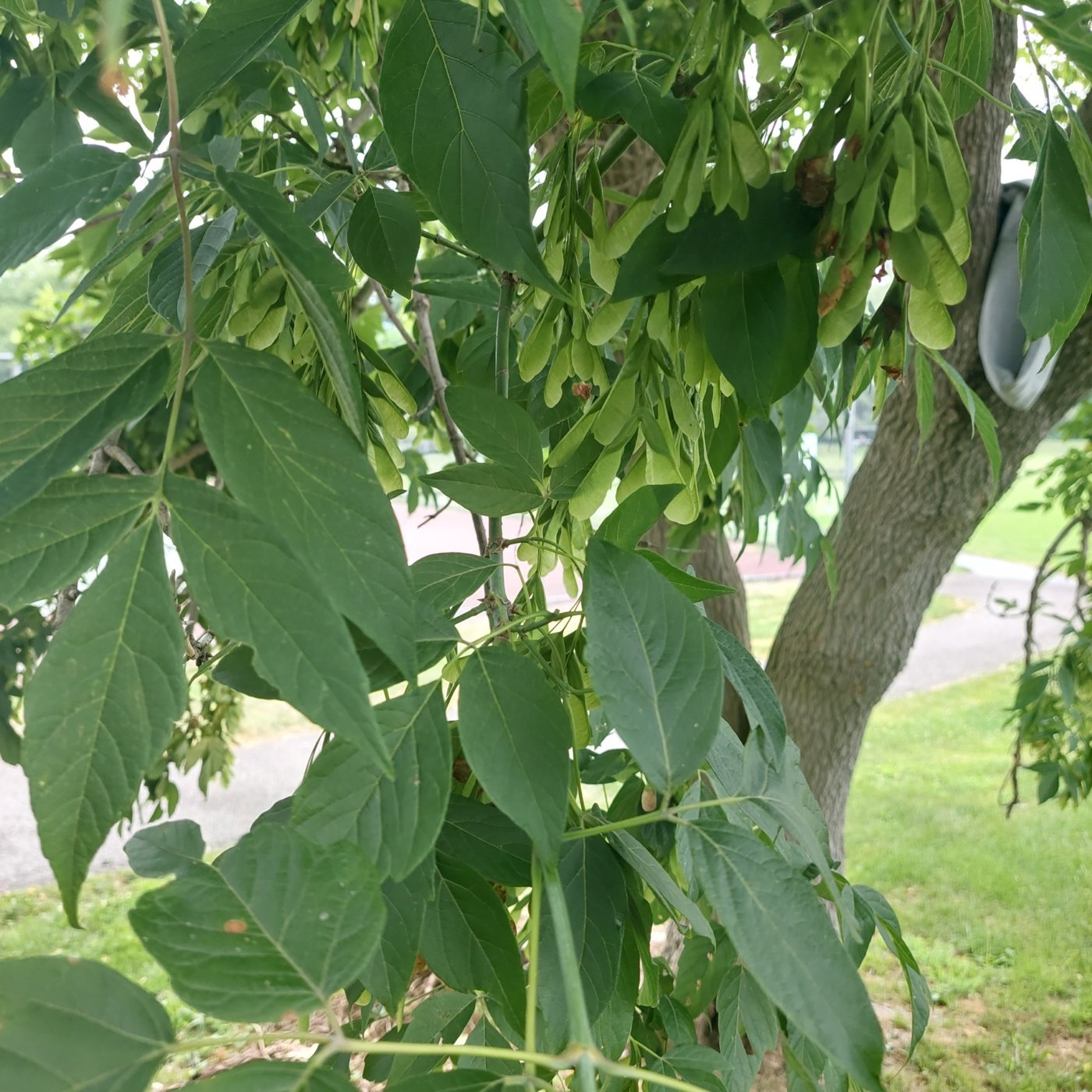
BOXELDER is native to a small area of the southwestern part of Massachusetts, but was largely planted as an ornamental tree throughout the state and has escaped in localized areas near habitation. It is a short-lived, fast-growing, medium-sized, brittle tree, typically reaching fifty to seventy feet tall and is subject to wind and ice damage.
Bark is light gray and smooth on young stems, becoming deeply furrowed forming longitudinal ridges on older trees.
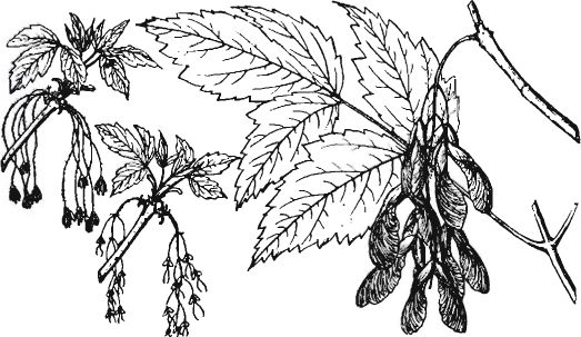
Leaves are light green, opposite, compound, usually five to seven leaflets per leaf, two to four inches long, and can vary greatly in shape.
Flowers open just before the leaves in spring and are yellow-green, and have no petals. Male and female flowers are borne on separate trees.
The fruit attains mature size in summer, ripening in autumn, consisting of a double winged pair of seeds. Wings are only slightly divergent and the seed body is wrinkled, three times longer than broad.
Twigs are smooth, rather stout, green to purplish green in color, and covered with a grayish waxy bloom.
The wood is light, soft, creamy white, weak, and close-grained. Occasionally it is used for pulp, crates, and fuel. Maple sugar can be made from the sap.
Where it grows
Mapped in 13 of fourteen counties: Barnstable, Berkshire, Bristol, Essex, Franklin, Hampden, Hampshire, Middlesex, Nantucket, Norfolk, Plymouth, Suffolk, Worcester.
In the forest record
Trees of this group (maple) were 6% of the trees surveyors recorded at lot corners before settlement and are 28% of trees on inventory plots today, statewide.
Each town’s own numbers are on its habitat, forest and water page.
The maple group is among the three most common kinds of tree in the surveyors’ record of 49 of the 164 towns with a surviving record, and the largest share of that record is in West Stockbridge (33%), Pittsfield (25%), Lanesborough (23%). The record is by group of trees, not by species, and covers towns with at least 50 recorded trees for the “largest share” list.
Insects and disease on the record
| Agent | Years seen | Worst year | Acres that year | Last seen |
|---|---|---|---|---|
| Winter moth | 13 | 2011 | 88,793 | 2018 |
Acres are of mapped damage, which can include other trees and non-forest; some agents attack several hosts.
Text and line illustrations: Forest Trees of Massachusetts, 7th edition (2016), Massachusetts Department of Conservation and Recreation, Bureau of Forest Fire Control and Forestry, funded by the USDA Forest Service. Drawings, 1925 descriptions and the “How to know” keys: The Commercial Forest Trees of Massachusetts (1925), Massachusetts Department of Conservation, Division of Forestry. Forest shares before settlement and today: Harvard Forest data archive (Cogbill, Burk and Motzkin 2002; Thompson and others 2013). Insects and disease: USDA Forest Service Insect and Disease Survey, Region 9, with DCR. Photographs: observations on iNaturalist (inaturalist.org), each credited to its photographer under its Creative Commons licence; the list is under “Where the pictures come from” on the guide page. Species ranges by county are as the 2016 manual maps them. Transcribed by script and proofread in part; the manuals govern where they differ.