Stockbridge · National Register
Naumkeag
Historic district · listed 1975 · National Historic Landmark
- Type
- Historic district
- Town
- Stockbridge
- Listed
- 1975
- Landmark
- National Historic Landmark
- Location
- 5 Prospect Hill Rd.
- Areas of significance
- Architecture; Landscape Architecture; Law; Politics/Government
- Architectural classification
- Queen Anne
- Reference number
- 75000264
About this listing
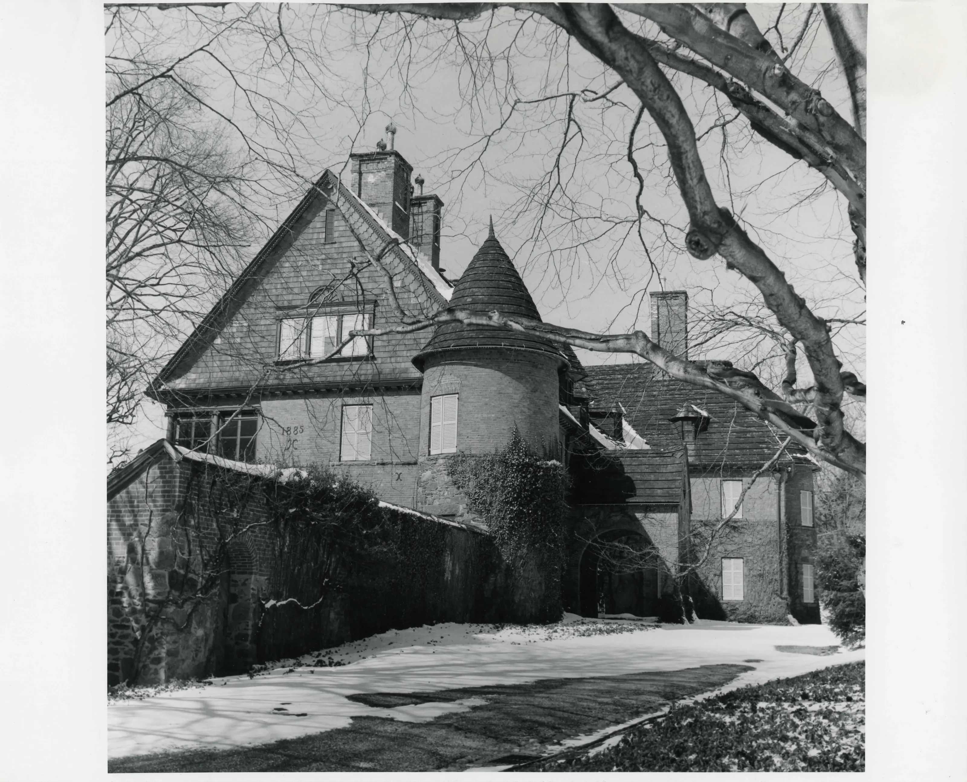
Queen Anne house designed by Stanford White and built in 1886 for Joseph Hodges Choate on Prospect Hill, with terraced gardens by Nathaniel Barrett, later extended by Fletcher Steele for Choate's daughter Mabel.
- Built
- 1886
- Architect / builder
- Stanford White; Nathaniel Barrett (landscape); Fletcher Steele (landscape)
- Style
- Queen Anne
- Significance and period
- Architecture; Landscape architecture
- People named
- Joseph Hodges Choate; Mabel Choate
Two broad lawn terraces by Nathaniel Barrett fitted the house and gardens to a steep site; four decades later Fletcher Steele extended them.
“The main (east) facade is brick, and the house is entered through an arched doorway by way of a porte-cochere.”
National Register nomination
Summary paraphrased from the nomination text; the form is linked below.
The scanned form’s text could not be separated into its description and significance sections reliably, so those two sections are not quoted here. The full form is linked below.
Nearby listings in Stockbridge
Sources, rights and limits
- Listing facts. National Park Service, National Register of Historic Places spatial data, queried 6 November 2026: type, year listed, landmark status, map location. U.S. government work, public domain.
- Nomination text and areas of significance. National Archives catalog record 63794304, “Massachusetts SP Naumkeag”. National Register nomination forms are U.S. government records and public domain. The quoted text is the catalog’s text layer (machine reading of the scan, 2024-04-06), not a transcription.
- Photographs. Photographs are reproduced from the nomination file at the National Archives with the photographer’s credit as typed on the print; rights may remain with the photographer. Write to hello@parcenomics.com to have one removed.
- Location line. Address as in the Park Service layer.
- Outline. Town boundary from the Commonwealth’s town layer, generalized. Not a survey.