1 · Nature
1
state-listed species on record
It has been recorded since 2001. Lynn has 16, Salem 16 and Marblehead 4; Swampscott is 348th most of 351.
Essex County · Swampscott
Town · 15,277 residents · 3.0 square miles
Swampscott has 1 state-listed species on record, 348th most of 351; Lynn has 16 and Salem 16.
For five years I served on a select board, including as its chair. Every budget season brought the same question: what do we appropriate, and how much should we raise? It struck me that the data needed to make good decisions, and how it all related, was often lacking. I set out to create a space where, for every town in the Commonwealth, we could weave these threads together into a narrative that informs good decision-making. That’s what Massanomics provides: not just information on budgets, land, water, climate and disasters, but a coherent story drawn from the many public sources available.
For Swampscott, that means 3% core habitat, 4.3 of 44.6 public road miles in the FEMA 1% flood zone and $6,662 per resident in gross formula aid over ten years.
Patrick White, former Chair, Stockbridge Select Board
Nature and money, in turn
1 · Nature
1
state-listed species on record
It has been recorded since 2001. Lynn has 16, Salem 16 and Marblehead 4; Swampscott is 348th most of 351.
2 · Money
$552,000
in local earmarks, ten state budgets
In ten enacted state budgets, FY2017 to FY2026, that is $36.11 per resident, 215th of 351. Lynn had $8.9 million, Salem $7 million and Marblehead $442,000 placed in them.
3 · Nature
−3.6%
forest, 2001 to 2023
Forest and woody wetland, satellite land cover. Lynn −3.2% and Salem −2.3%; no figure for Marblehead. Swampscott is 183rd of 340 (1 = most gained).
4 · Money
10.1%
of spending covered by state aid
The median town’s share is 11.5%. Lynn is at 59.3%, Salem 22.3% and Marblehead 8.4%; Swampscott’s is 154th lowest of 346.
FY2025. Chapter 70 school aid paid to the regional district is outside this share.
5 · Nature
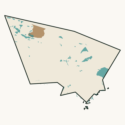
3%
of the land is core habitat
That is 54 acres, 340th of 351 by share of land; the median town has 25%. Lynn has 19%, Salem 5% and Marblehead 0%.
Swampscott is a town of 15,277 people on 3.0 square miles of Essex County, 5,055 to the square mile, among the most densely settled fifth of the state. Median household income is $134,000, above the median town’s $114,000. State aid covered 10.1% of its general-fund spending in FY2025; the median town’s share was 11.5%. On the Fairness Index it scores 28 for all state aid and 35 for discretionary money — below its share on both. Its Land and Water Index is 21, 305th of 351. On the strong side: it has lost 1.6% of its tree cover since 2001, about half of the statewide rate; Chapter 70 aid per pupil, after inflation, has risen 31% since FY2017.
Where it comes up short: 100% of its assessed lake acres and river miles are on the state’s impaired list; only 3% of its land is mapped core habitat; formula aid came to $6,662 per resident over ten years, 307th of 351.
The openings are specific: its ten nearest peers’ median earmark per resident is $58.05 against its own $36.11, so towns like it do receive earmarks; $421,000 of its Chapter 90 road money is apportioned and not yet drawn.
The money
Swampscott’s town government and school districts received $102 million in formula aid and $3 million in competitive grants over ten years.
Fairness Index · all state aid
28 / 100
322nd of 351
Fairness Index · discretionary money
35 / 100
249th of 351
The land
Swampscott has 54 acres of mapped core habitat, 3% of its land area; 54 of those acres are outside any protected land.
Habitat, forest and water ›Who represents Swampscott
To pass along
Nature
Swampscott has 1 state-listed species on record, 348th most of 351; Lynn has 16 and Salem 16.
Money
Swampscott had $552,000 in local earmarks placed in it over ten enacted state budgets, $36.11 per resident, 215th of 351; Lynn had $8.9 million and Salem $7 million.
Forest
Swampscott’s forest changed by −24.6% from 1971 to 1999, 315th of 351 (1 = most gained); Lynn −6.5% and Salem −18.3%.
This is your town, your city, the place you will spend these days of your life. The quality of that life depends on good decisions. I am a lifelong resident of Massachusetts and care deeply about this place. If we can be of service, write hello@parcenomics.com, or ask me to present to your board.
Sources: MassWildlife NHESP rare-species records by town, to 2025; MassWildlife BioMap 2022; MassGIS land use 1971–1999, USGS land cover 2001–2023 and DCR forest 2021; 1830 town plans, Massachusetts Archives, via Digital Commonwealth; Comptroller, Division of Local Services and DESE records through FY2026. Land layers as published 1 November 2026; money figures as built 3 November 2026. Every figure links to Swampscott’s money page or Swampscott’s land page.