Commonwealth Report Findings Land and water For policymakers History Elected Officials Updates Weekly Method Search

Egremont · National Register

South Egremont Village Historic District

Historic district · listed 1984

Type
Historic district
Town
Egremont
Listed
1984
Location
MA 23-41, Buttonball Lane, Sheffield, and Pinecrest Hill Rds.
Areas of significance
Archeology: Prehistoric; Archeology: Historic; Agriculture; Architecture; Art; Commerce; Education; Engineering; Industry; Invention; Politics/Government; Religion; Social/Humanitarian; Transportation; Community Development
Architectural classification
Federal; Greek Revival; Gothic Revival; Italianate; Shingle
Reference number
84002086

About this listing

Village district of about 375 acres on both sides of Route 23 in South Egremont, along Karner Brook. It holds 59 historic homes and structures and five intrusions, with houses, a church, a tavern, stores and mill sites. Buildings range from the mid-18th century to about 1900. The 1801 turnpike drove the village's growth.

Built
mid-18th century-ca. 1900
Style
Federal; Greek Revival; late 19th-century styles with Gothic Revival, Italianate and Shingle Style treatments; vernacular design
Significance and period
Architecture; Community planning and development
People named
John Tuller

The 12th Massachusetts Turnpike, built through the south village in 1801, led a tavern keeper to move his tavern 100 feet east to catch the Hartford-Albany trade. Houses and the church stand back from the road.

“a distinctive grouping of late 18th and 19th century residential, commercial, industrial and institutional architecture”

National Register nomination

Summary paraphrased from the nomination text; the form is linked below.

The scanned form’s text could not be separated into its description and significance sections reliably, so those two sections are not quoted here. The full form is linked below.

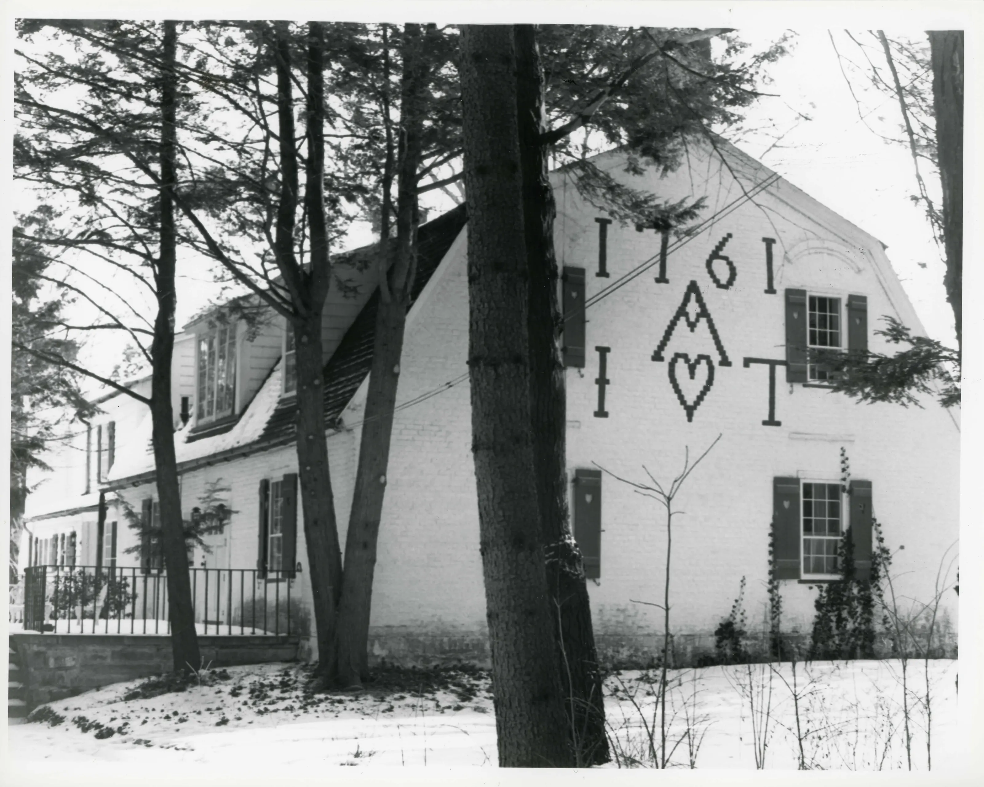
View east of west gable of John Tullar House, 1761
View east of west gable of John Tullar House, 1761Photo: James N. Parrish, 12/80. From the National Register nomination, National Archives.
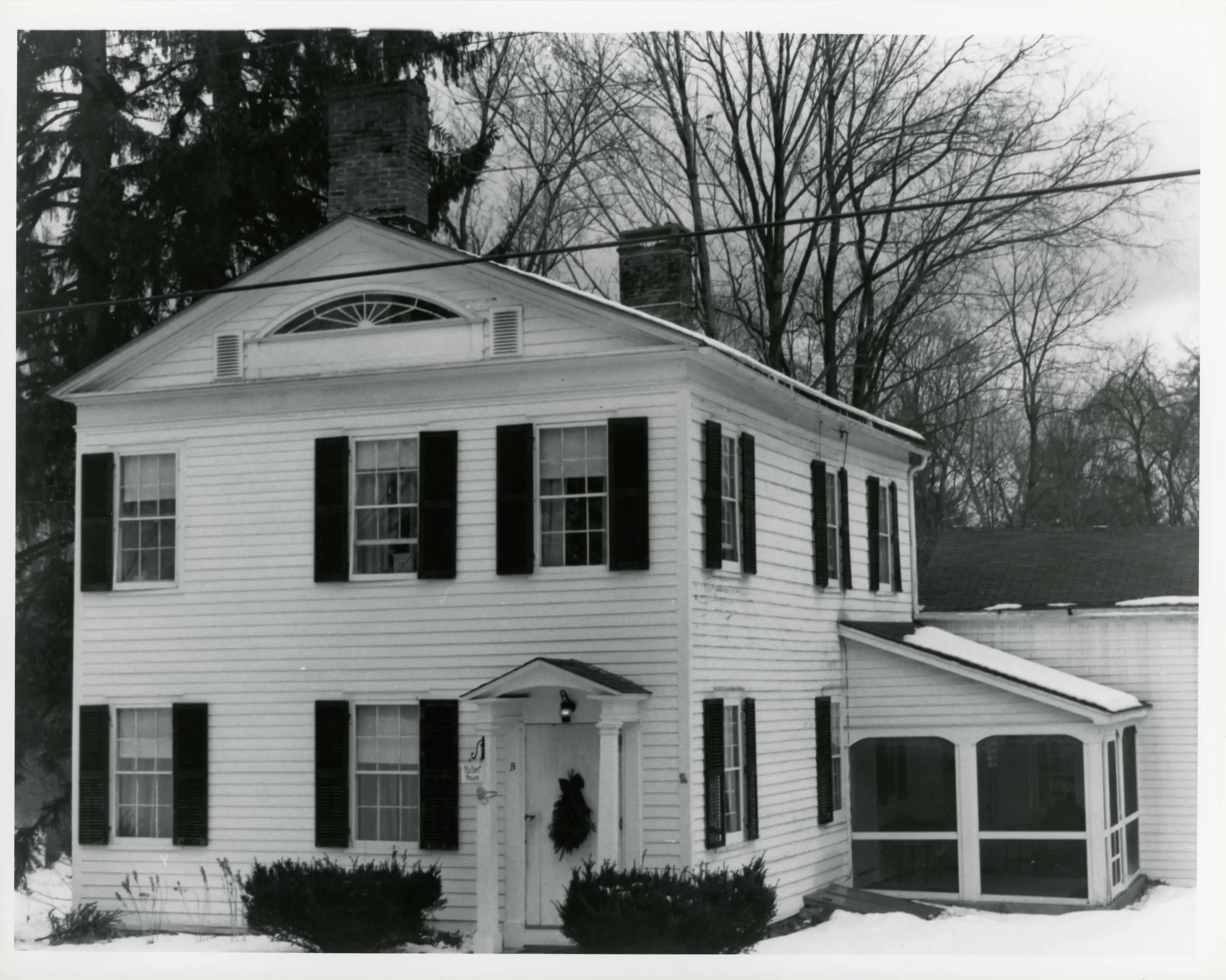
Levi Warner House, 1812. View easterly from highway of front facade, showing elongated fan light, freeze & pilaster, common to area.
Levi Warner House, 1812. View easterly from highway of front facade, showing elongated fan light, freeze & pilaster, common to area.Photo: James N. Parrish, 12/80. From the National Register nomination, National Archives.
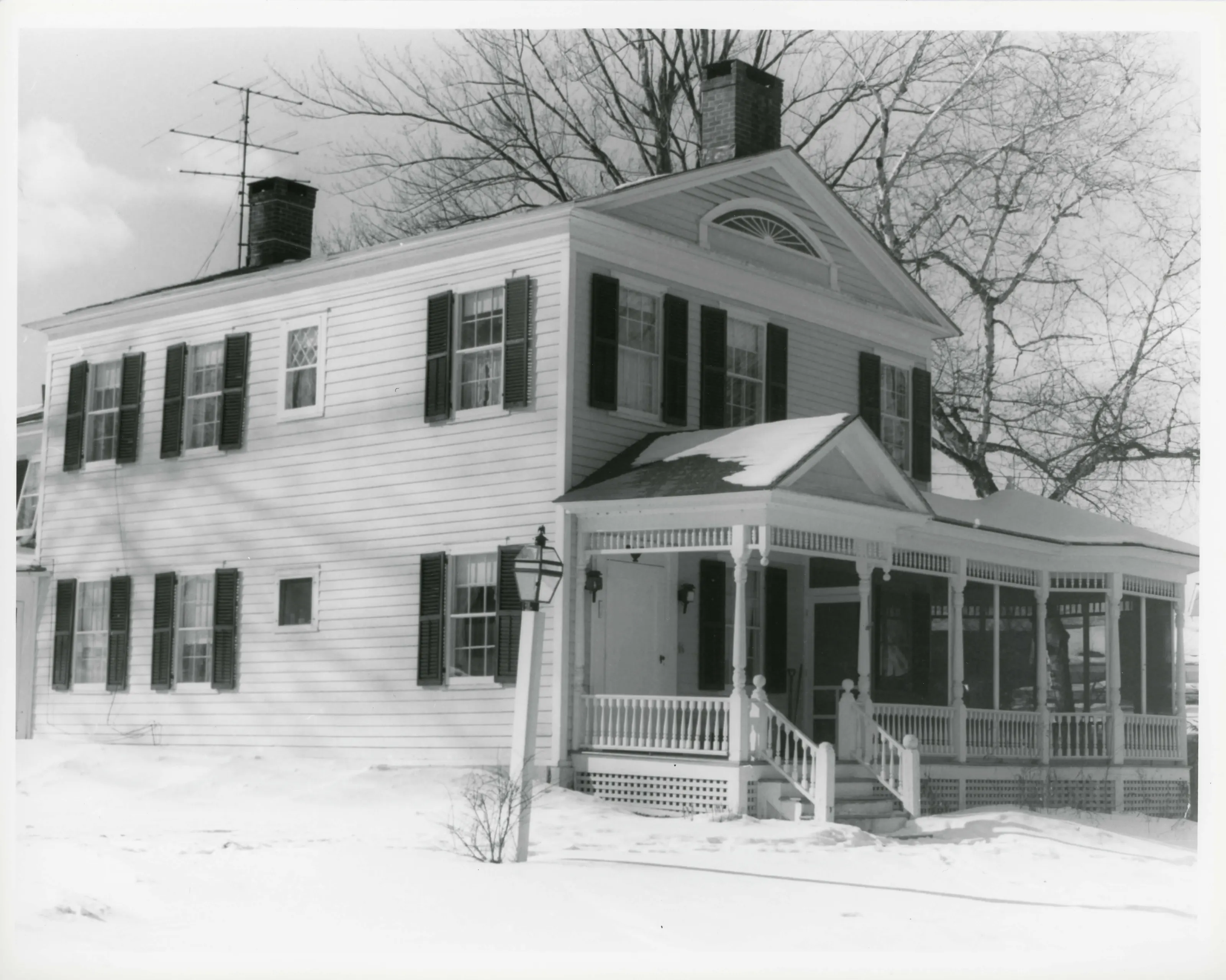
Hasty House, 1815. View northwest from highway, showing front facade, similar to the Levi Warner House, M8, and the Nathan Benjamin House, M46.
Hasty House, 1815. View northwest from highway, showing front facade, similar to the Levi Warner House, M8, and the Nathan Benjamin House, M46.Photo: James N. Parrish, 12/80. From the National Register nomination, National Archives.
N. K. Bills Store - Hawthorne Apartments, 1825-30. View east of N. K. Bills Store, later A. A. Benjamin Insole Factory, 1879-1895.
N. K. Bills Store - Hawthorne Apartments, 1825-30. View east of N. K. Bills Store, later A. A. Benjamin Insole Factory, 1879-1895.Photo: James N. Parrish, 12/80. From the National Register nomination, National Archives.
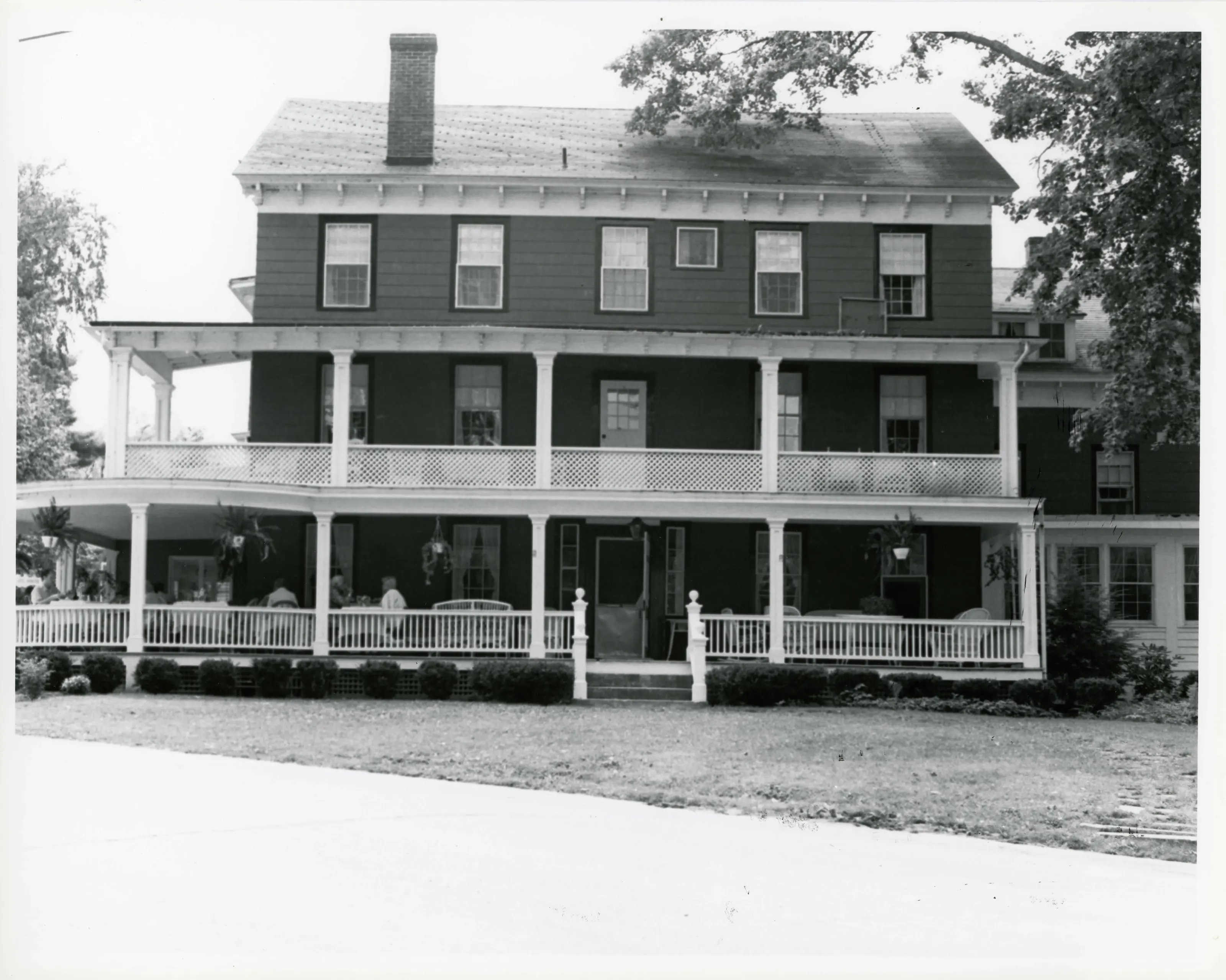
Hare Tavern, Mt. Everett Inn, Egremont Inn 1780/1801. View southwest of front facade of the Egremont Inn, moved forward in 1801, third floor added in 1853.
Hare Tavern, Mt. Everett Inn, Egremont Inn 1780/1801. View southwest of front facade of the Egremont Inn, moved forward in 1801, third floor added in 1853.Photo: James N. Parrish, 8/80. From the National Register nomination, National Archives.
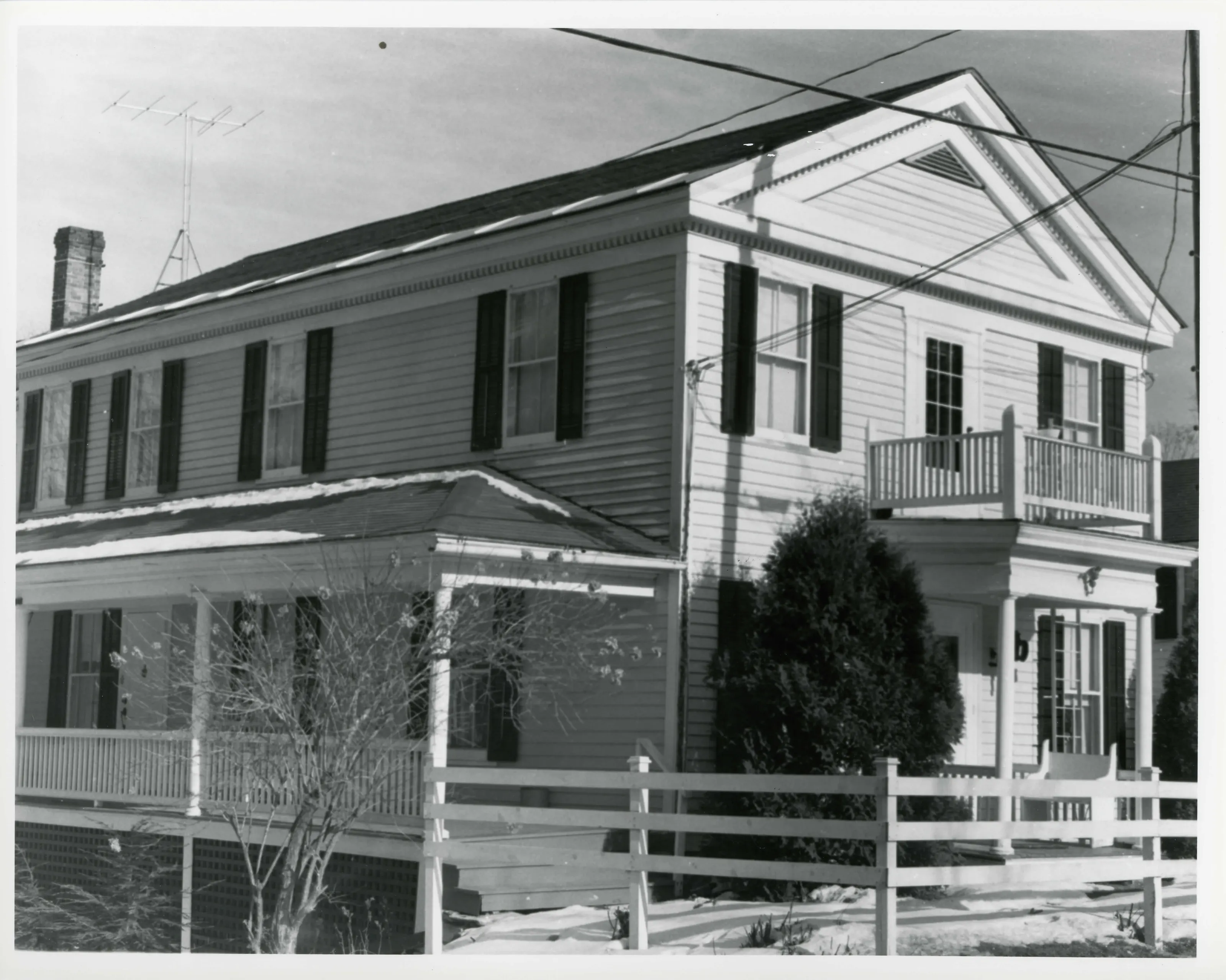
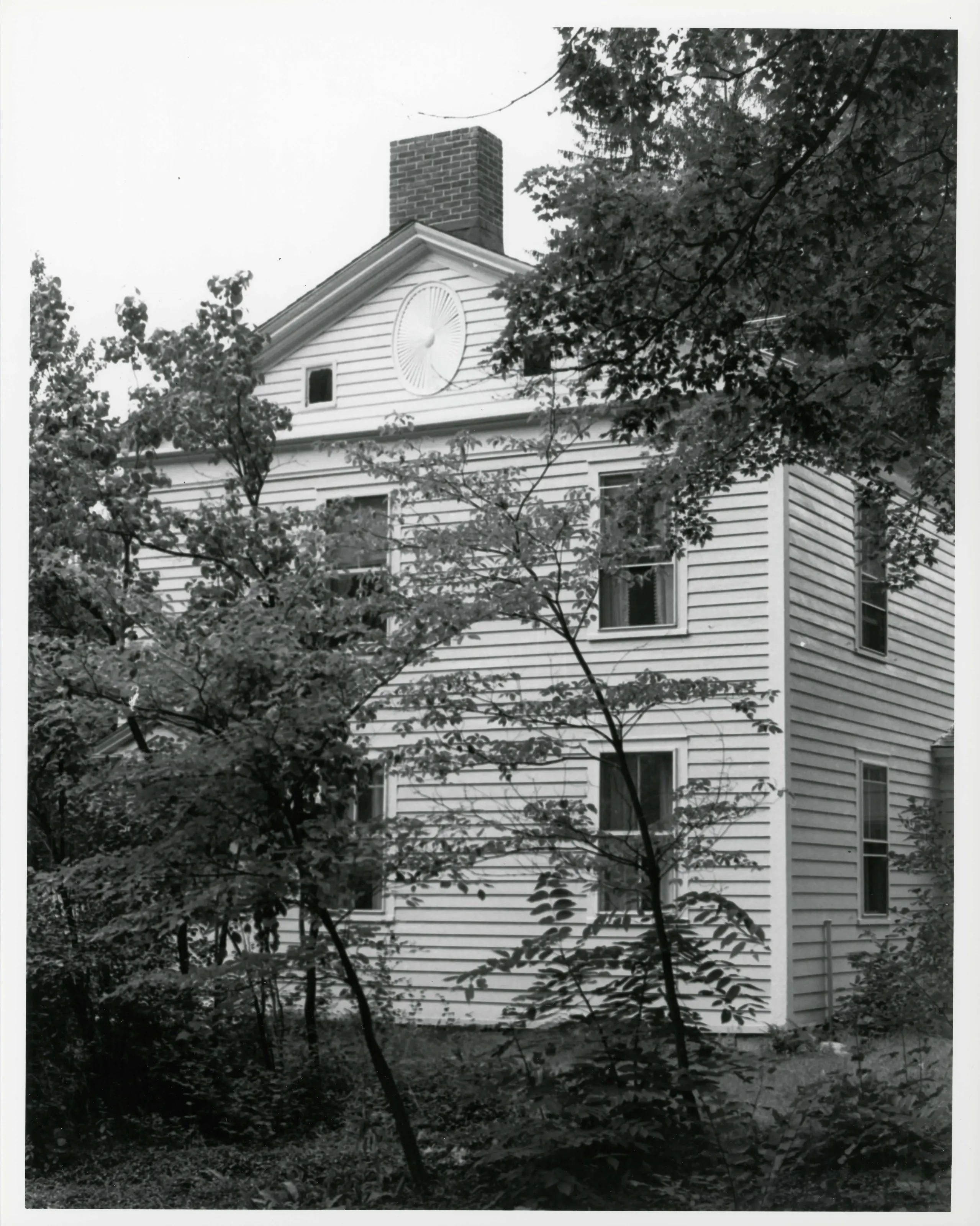
Samuel Bacon House, 1810-1815. View westerly from road of front gable end of house, showing oval wood fan in gable.
Samuel Bacon House, 1810-1815. View westerly from road of front gable end of house, showing oval wood fan in gable.Photo: James N. Parrish, 8/80. From the National Register nomination, National Archives.
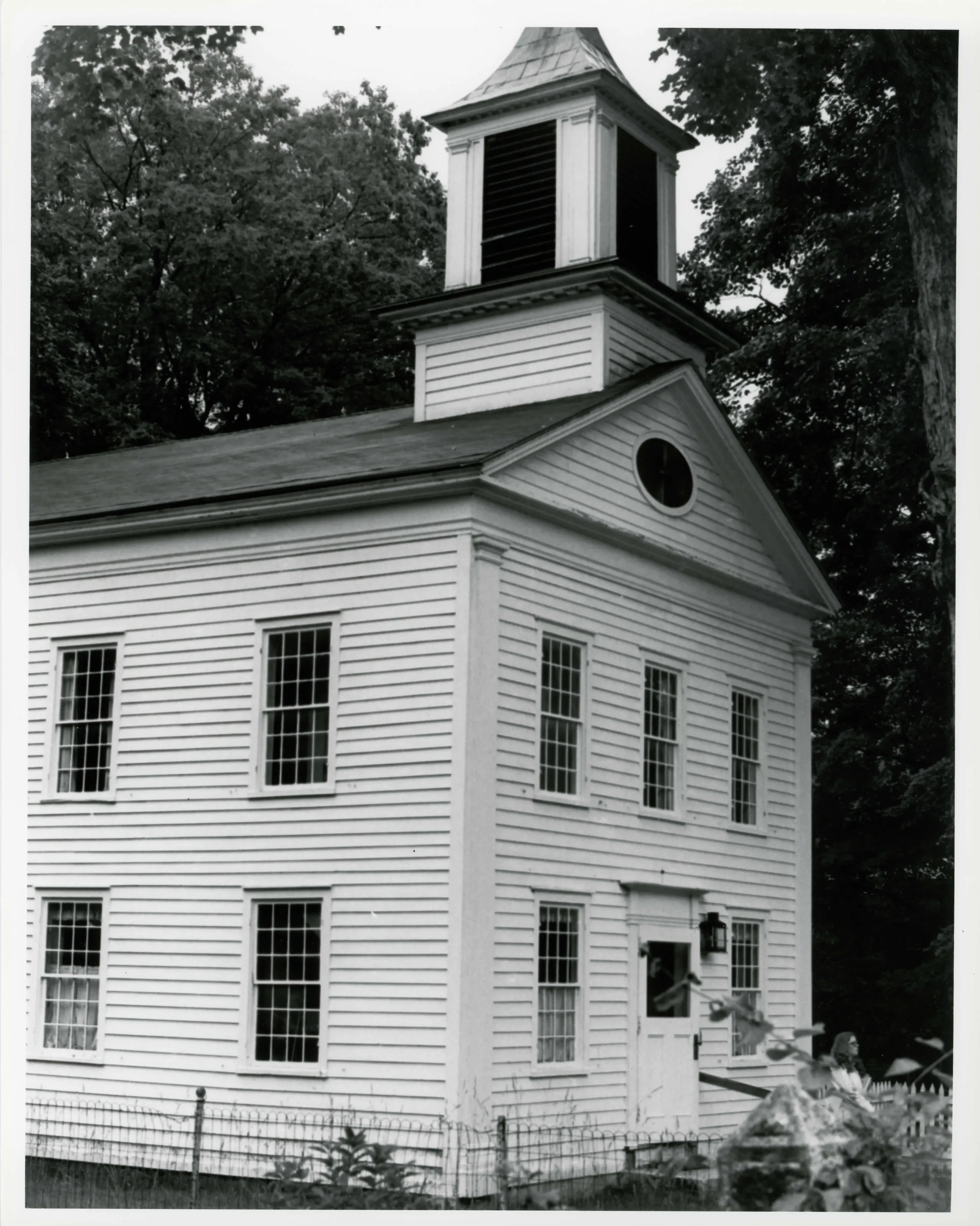
Mount Everett Academy, 1831-1832, Present Town Library and Historical Room. View southeast of front facade and lantern, Tisted on H.A.B.S. Survey 1935.
Mount Everett Academy, 1831-1832, Present Town Library and Historical Room. View southeast of front facade and lantern, Tisted on H.A.B.S. Survey 1935.Photo: James N. Parrish, 8/80. From the National Register nomination, National Archives.
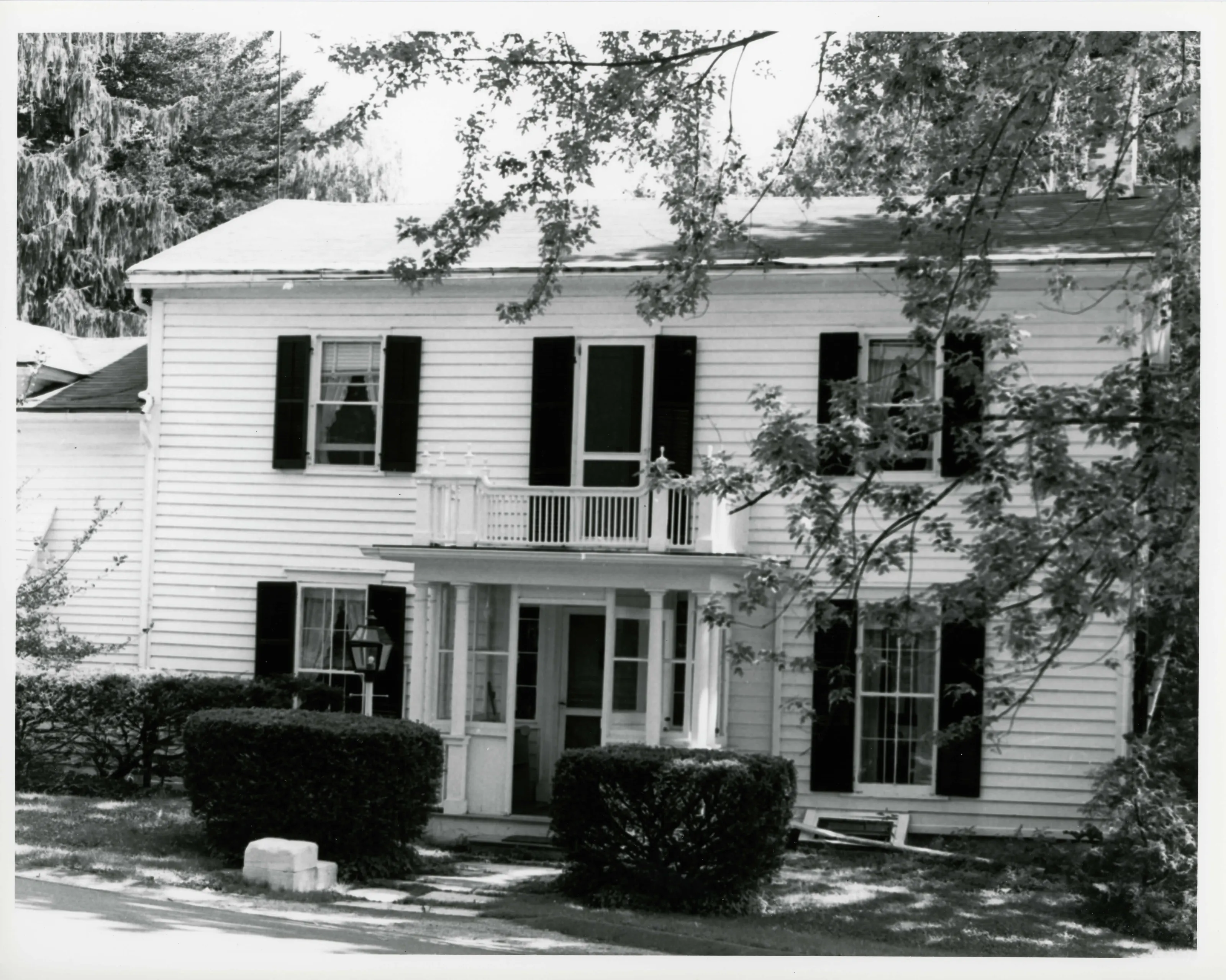
Chester Goodale 1st House, 1819-1820. View east of street facade, cellar entry west side, porch on east opposite.
Chester Goodale 1st House, 1819-1820. View east of street facade, cellar entry west side, porch on east opposite.Photo: James N. Parrish, 8/80. From the National Register nomination, National Archives.
The pin marks the center of the listed area as the Park Service maps it, on the outline of Egremont.
Sources, rights and limits
  • Listing facts. National Park Service, National Register of Historic Places spatial data, queried 6 November 2026: type, year listed, landmark status, map location. U.S. government work, public domain.
  • Nomination text and areas of significance. National Archives catalog record 63794156, “Massachusetts SP South Egremont Village Historic District”. National Register nomination forms are U.S. government records and public domain. The quoted text is the catalog’s text layer (machine reading of the scan, 2025-07-29), not a transcription.
  • Photographs. Photographs are reproduced from the nomination file at the National Archives with the photographer’s credit as typed on the print; rights may remain with the photographer. Write to hello@parcenomics.com to have one removed.
  • Location line. Address as in the Park Service layer.
  • Outline. Town boundary from the Commonwealth’s town layer, generalized. Not a survey.