Sandisfield · National Register
Sage, Philemon, House
Building · listed 1982
- Type
- Building
- Town
- Sandisfield
- Listed
- 1982
- Location
- MA 183
- Areas of significance
- Archeology: Historic; Agriculture; Architecture; Commerce; Exploration/Settlement; Industry
- Architectural classification
- Federal
- Reference number
- 82001898
About this listing
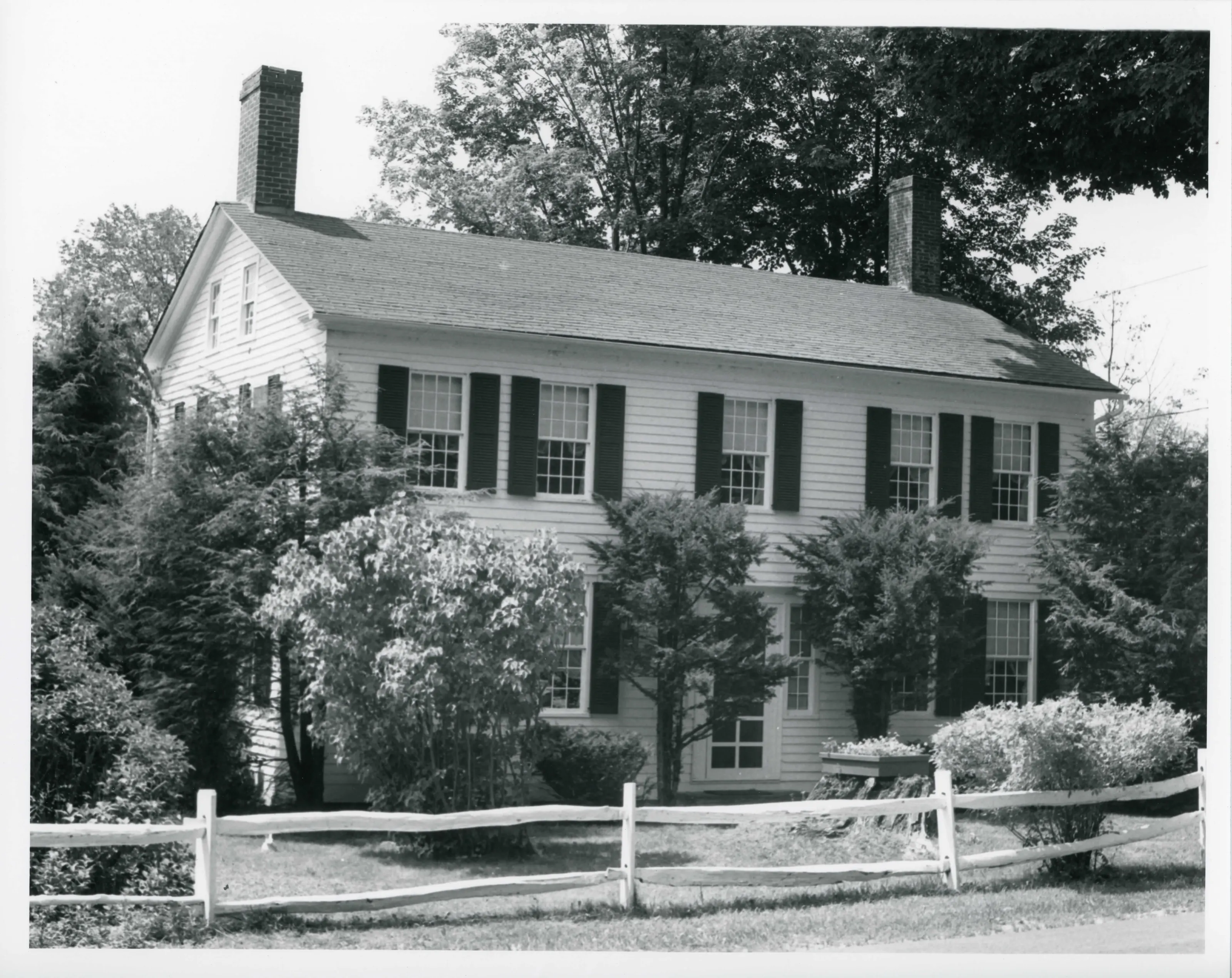
Farmhouse in the far southwest corner of Sandisfield, with an 1827 two-and-a-half-story front section and an earlier 1799 section renovated at the same time. It stands on forty acres beside the Sandy Brook Turnpike, now Marlborough Road, and shows the farm and industrial activity of the early nineteenth century.
- Built
- 1799 section; 1827 main building
- Style
- Vernacular
- Significance and period
- Architecture (early 19th century)
- People named
- Philemon Sage
Goods produced on the farm were traded locally and regionally by way of the Sandy Brook Turnpike. Sandisfield became a town in 1762.
“a well preserved example of vernacular domestic architecture in the early part of the nineteeth century”
National Register nomination
Summary paraphrased from the nomination text; the form is linked below.
What the nomination says it is
The Philemon Sage House sits isolated in a narrow valley on a triangular plot of forty acres south and west of the intersection of the Sandy Brook Road (Turnpike), now Marlborough Road, the Norfolk Road and the Rood Hill Road. This intersection, in the extreme southwest corner of the town of Sandisfield, is one mile south of the small village of South Sandisfield and one mile north of the Massachusetts/Connecticut border.
From the National Register nomination, 1982.
Quoted from the scanned form as the National Archives’ text layer reads it. Line breaks are joined; reading errors are left as they are.
Nearby listings in Sandisfield
Sources, rights and limits
- Listing facts. National Park Service, National Register of Historic Places spatial data, queried 6 November 2026: type, year listed, landmark status, map location. U.S. government work, public domain.
- Nomination text and areas of significance. National Archives catalog record 63794130, “Massachusetts SP Sage, Philemon, House”. National Register nomination forms are U.S. government records and public domain. The quoted text is the catalog’s text layer (machine reading of the scan, 2025-07-29), not a transcription.
- Photographs. Photographs are reproduced from the nomination file at the National Archives with the photographer’s credit as typed on the print; rights may remain with the photographer. Write to hello@parcenomics.com to have one removed.
- Location line. Address as in the Park Service layer.
- Outline. Town boundary from the Commonwealth’s town layer, generalized. Not a survey.