North Adams · National Register
Church Street--Caddy Hill Historic District (Boundary Increase)
Historic district · listed 1985
- Type
- Historic district
- Town
- North Adams
- Listed
- 1985
- Multiple property listing
- North Adams MRA
- Location
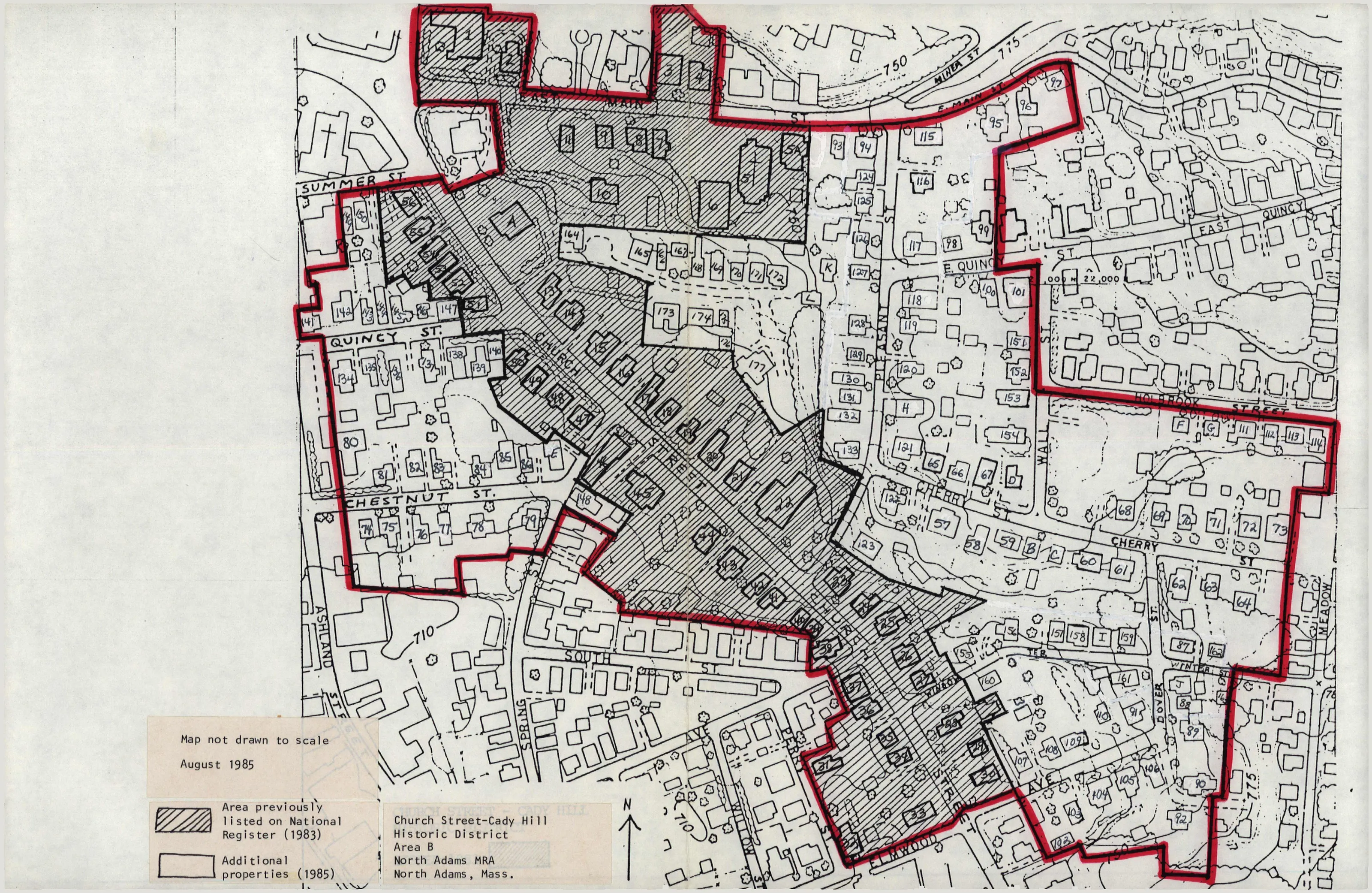
- Roughly bounded by E. Main and Holbrook Sts., Wall and Meadow Sts., Elmwood Ave., and Perry, South, and Ashland Sts.
- Areas of significance
- Industry; Community Planning and Development; Commerce; Architecture
- Architectural classification
- Greek Revival; Italianate; Second Empire; Gothic Revival; Shingle Style; Victorian; Queen Anne; Colonial Revival; Vernacular; Arts and Crafts
- Reference number
- 85003376
About this listing
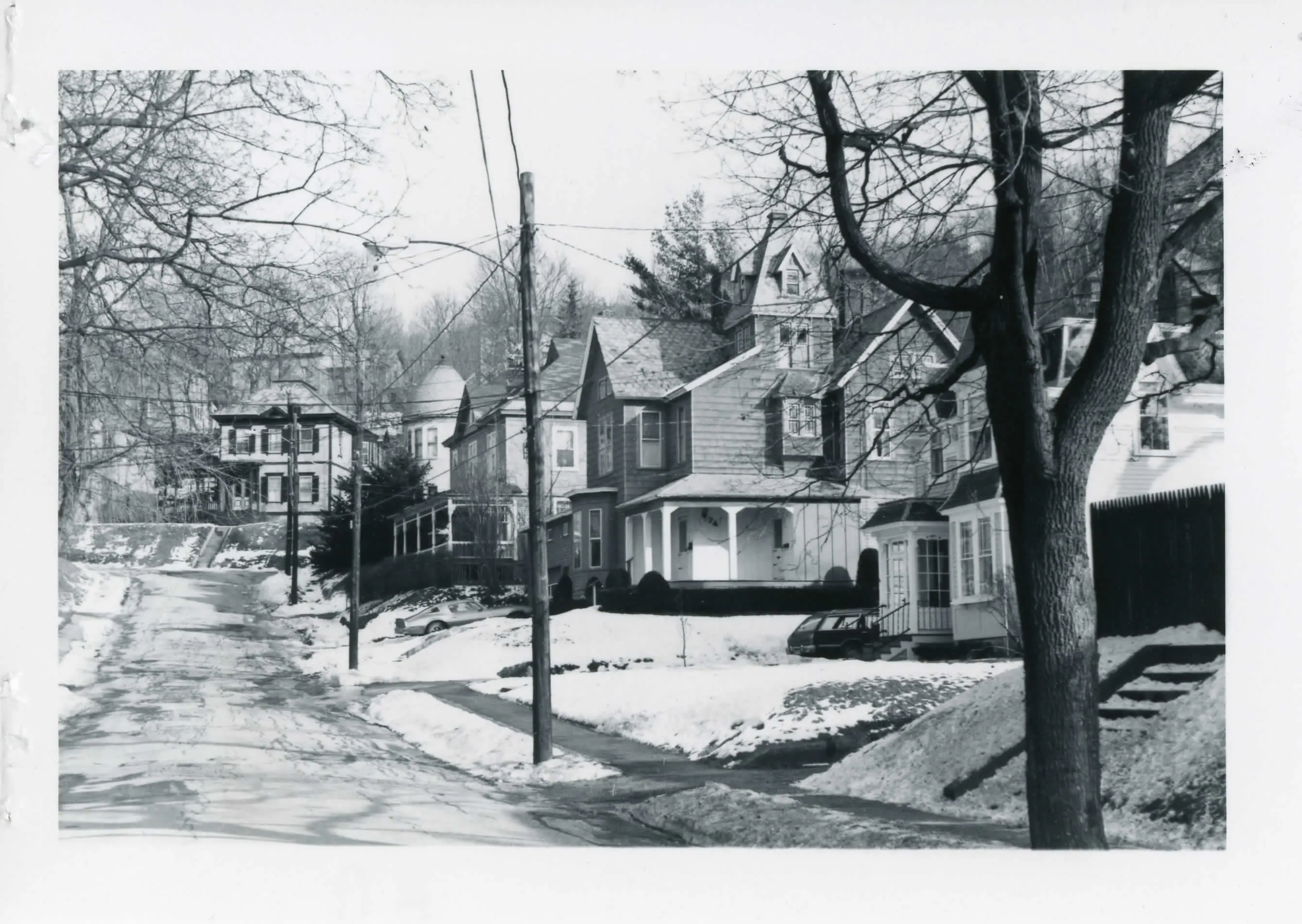
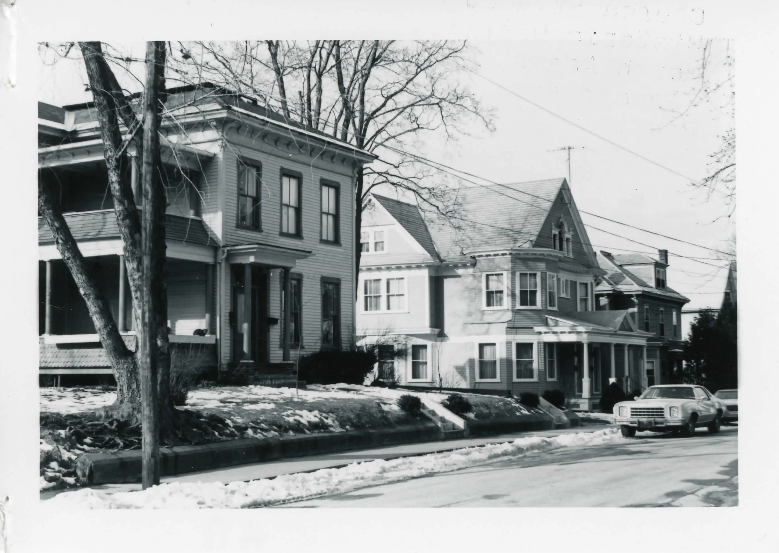
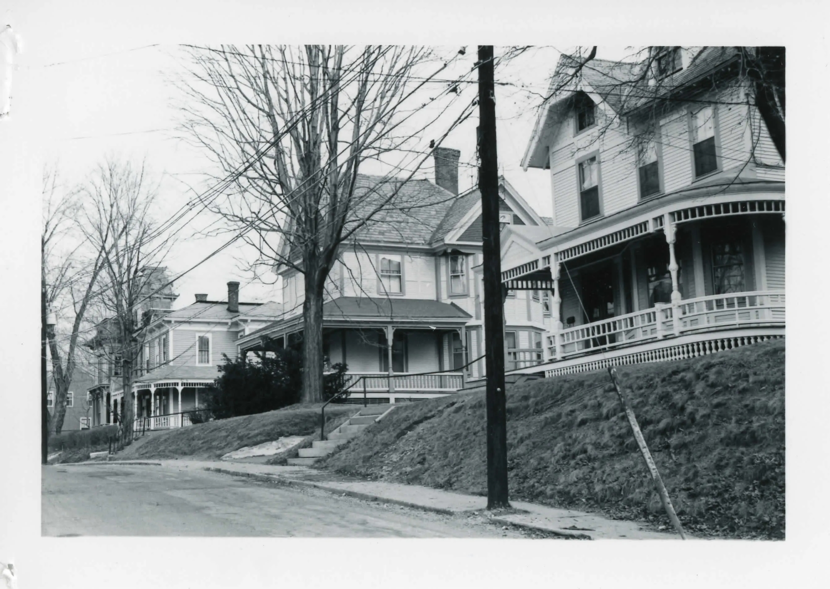
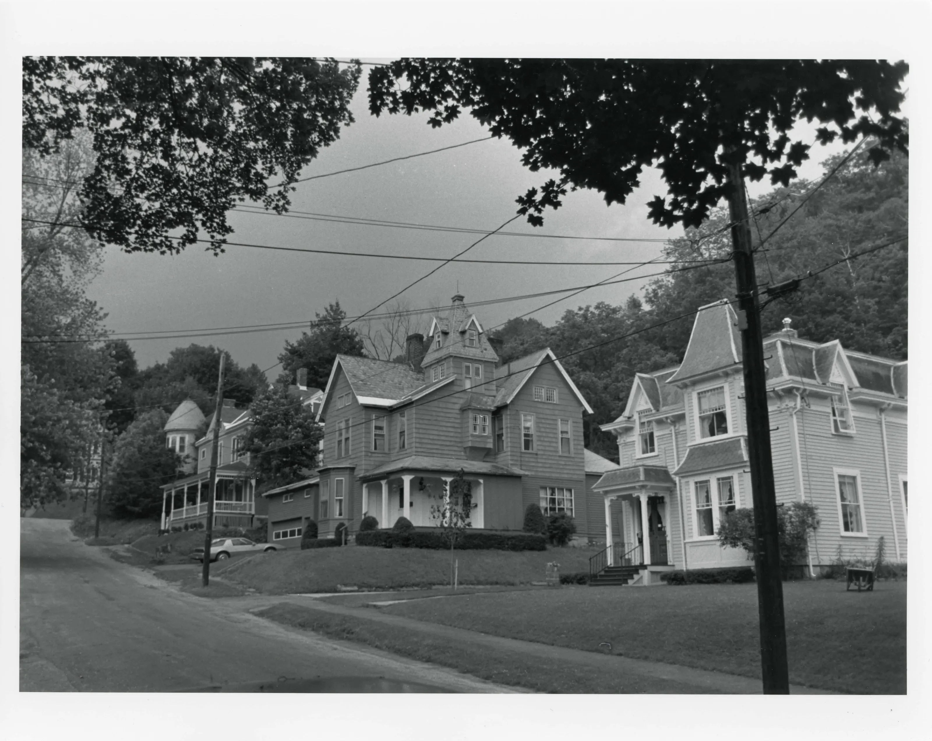
Boundary increase to the Church Street district in North Adams, renamed Church Street-Cady Hill. It adds a block each of Quincy and Chestnut Streets and Cady Hill, east of Church Street. The area has 179 properties, 165 contributing, all residential, mostly wood-frame houses built 1860-1900 for mill owners, merchants and managers.
- Built
- 1860-1900
- Style
- Greek Revival, Italianate, Second Empire and other late 19th-century styles
- Significance and period
- Architecture; Community planning and development (1840-1920)
Cady Hill is somewhat more modest than Church Street, a mix of large and medium-sized single-family houses. Mill owners and merchants lived beside upper-level mill managers.
“is historically significant as a physical manifestation of North Adams' increasing prosperity in the second half of the 19th century”
National Register nomination
Summary paraphrased from the nomination text; the form is linked below.
The scanned form’s text could not be separated into its description and significance sections reliably, so those two sections are not quoted here. The full form is linked below.
Nearby listings in North Adams
- Armstrong House
- Arnold Print Works
- Beaver Mill
- Blackinton Historic District
- Boardman, The
- Browne, Charles, House
- Church Street Historic District
- Crowley House
- Freeman's Grove Historic District
- Freight Yard Historic District
- H.W. Clark Biscuit Company
- Hathaway Tenement
- Hillside Cemetery
- Hoosac Tunnel
- Johnson Manufacturing Company
- Johnson School
- Monument Square--Eagle Street Historic District
- Monument Square--Eagle Street Historic District (Boundary Increase)
- Norad Mill
- Normal School Historic District
- Sherman, Eber, Farm
- Sherman, William B., Farm
- St. Joseph's School
- Sykes House
- Wells House
- Windsor Print Works
Sources, rights and limits
- Listing facts. National Park Service, National Register of Historic Places spatial data, queried 6 November 2026: type, year listed, landmark status, map location. U.S. government work, public domain.
- Nomination text and areas of significance. National Archives catalog record 63789279, “Massachusetts MPS Church Street-Cady Hill Historic District (Boundary Increase)”. National Register nomination forms are U.S. government records and public domain. The quoted text is the catalog’s text layer (machine reading of the scan, 2025-07-29), not a transcription.
- Photographs. Photographs are reproduced from the nomination file at the National Archives with the photographer’s credit as typed on the print; rights may remain with the photographer. Write to hello@parcenomics.com to have one removed.
- Location line. Address as in the Park Service layer.
- Outline. Town boundary from the Commonwealth’s town layer, generalized. Not a survey.