Commonwealth Report Findings Land and water For policymakers History Elected Officials Updates Weekly Method Search

New Marlborough · National Register

Mill River Historic District

Historic district · listed 1994

Type
Historic district
Town
New Marlborough
Listed
1994
Location
Roughly bounded by Main St. and River Church, Southfield, Clayton, School, and Hayes Hill Rds., Town of New Marlborough
Areas of significance
Politics/Government; Agriculture; Exploration/Settlement
Architectural classification
Federal; Gothic Revival; Greek Revival; Italianate; Queen Anne; Classical Revival; Colonial Revival; Georgian Revival; Romanesque Revival
Reference number
94000423

About this listing

Linear village of about 425 acres along the Konkapot River in New Marlborough, which the nomination calls the town's first settlement and mill site and a 19th-century manufacturing and town center. It has 103 contributing resources: 92 buildings and 11 sites, plus the remains of at least eight mills. Most buildings are mid-19th-century houses, institutions and shops.

Built
1742-ca. 1942
Style
Rural 19th-century vernacular; Classical Revival
Significance and period
Architecture; Archaeology (historic); Exploration/Settlement; Industry; Politics/Government (1742-ca. 1942)
People named
Nahum Ward; Benjamin Wheeler

Settlers contracted Nahum Ward to build mills; a sawmill stood by 1742 and a gristmill was begun in 1744. The period closes about 1942 with the nomination's last paper mill. The railroad bypassed the village, ending its industrial lead.

“the location of New Marlborough's first settlement and mill”

National Register nomination

Summary paraphrased from the nomination text; the form is linked below.

The scanned form’s text could not be separated into its description and significance sections reliably, so those two sections are not quoted here. The full form is linked below.

Nearby listings in New Marlborough
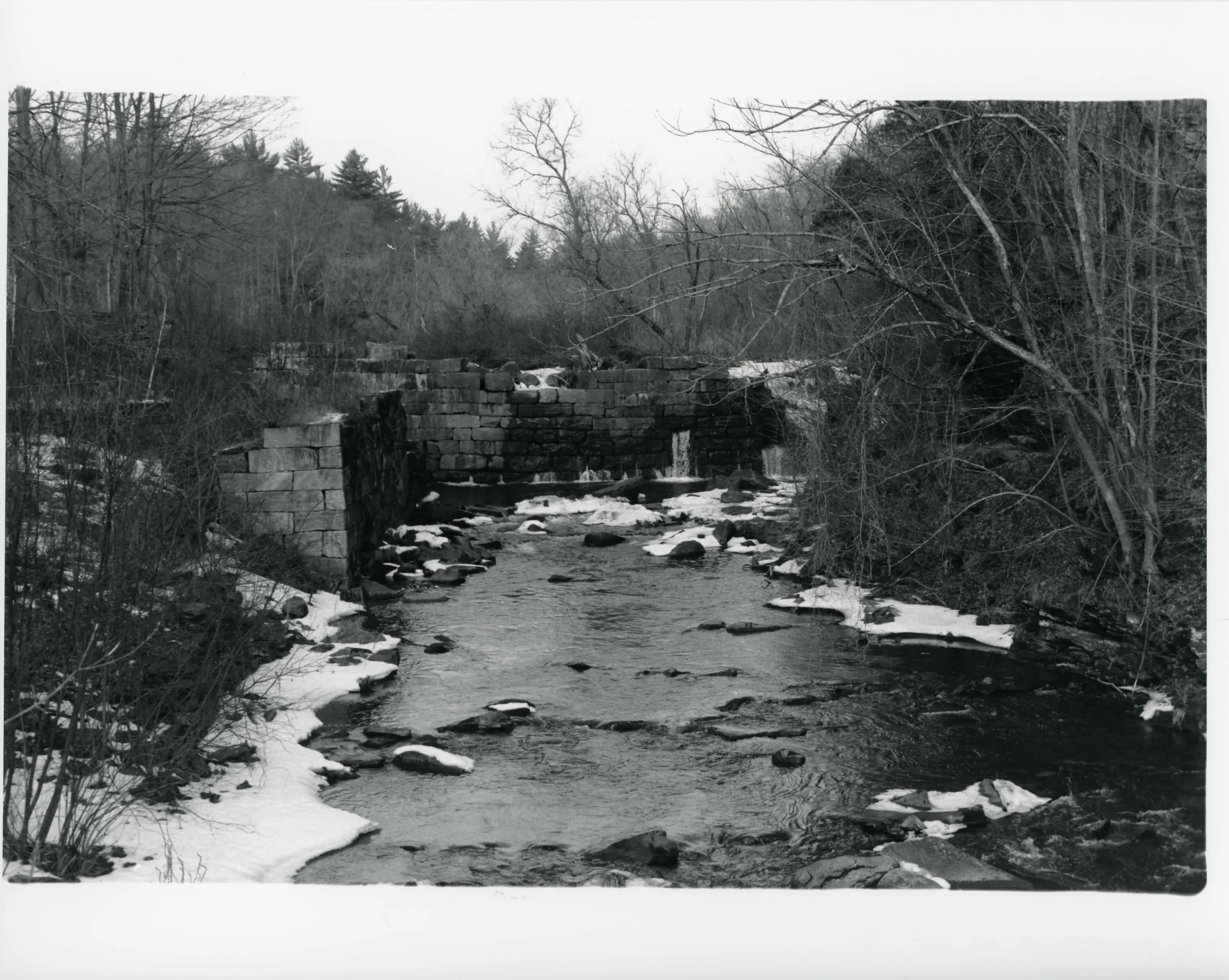
Site of Carroll Paper Co. of the 19th century, on the Konkapot River, looking east from the Mill River - Clayton Rd.
Site of Carroll Paper Co. of the 19th century, on the Konkapot River, looking east from the Mill River - Clayton Rd.Photo: Theodore Atkinson, 4 Jan. 1990. From the National Register nomination, National Archives.
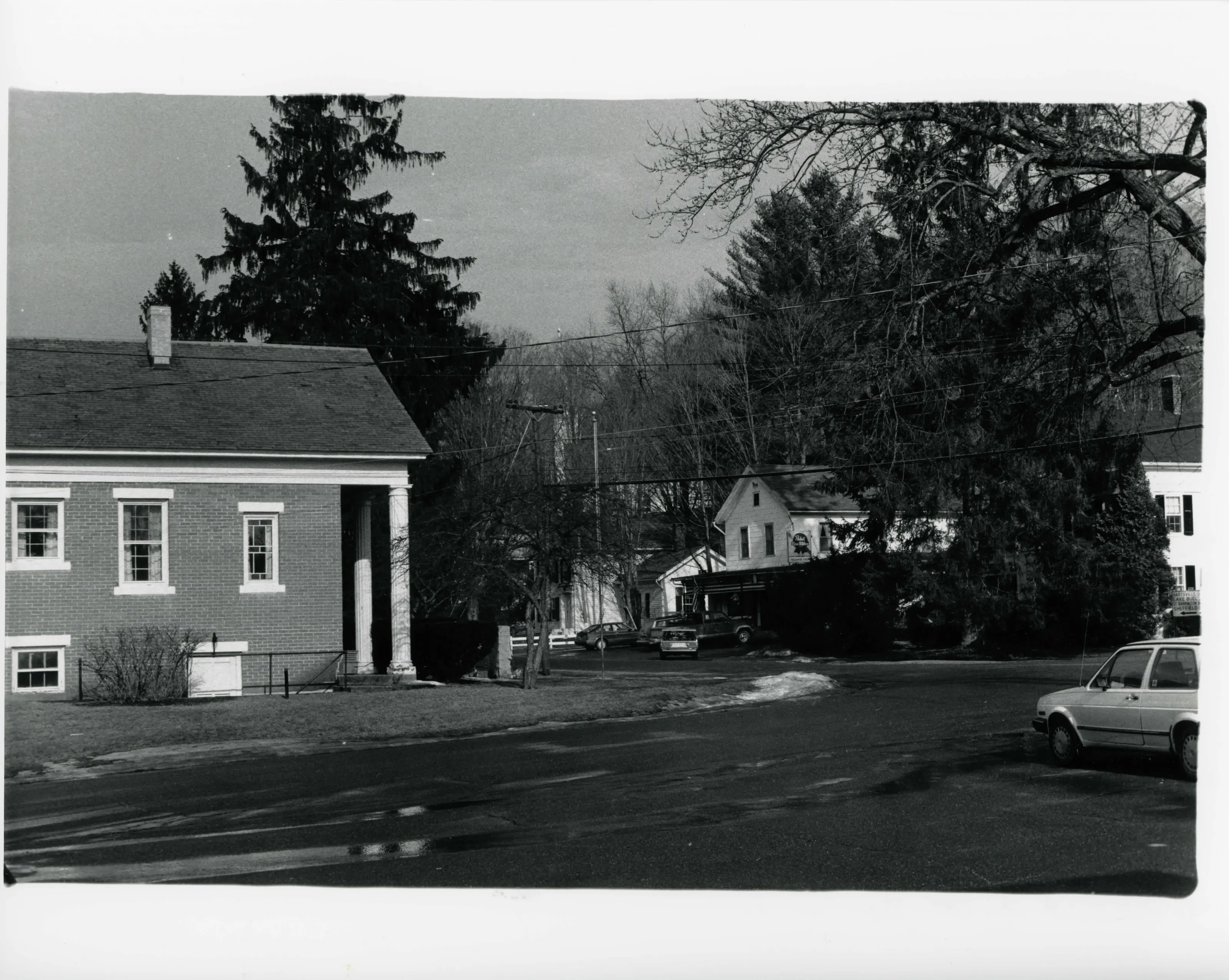
Looking west from the former Congregational Church; Town Hall on left, former home of Lorin Keyes (now Lehrman) on right, New Marlborough Public Library (with columns) at center
Looking west from the former Congregational Church; Town Hall on left, former home of Lorin Keyes (now Lehrman) on right, New Marlborough Public Library (with columns) at centerPhoto: Theodore Atkinson, 4 Jan. 1990. From the National Register nomination, National Archives.
Center of the Mill River Village, Main Street; public library on left, former home of Lorin Keyes (now Lehrman) on right, Mill River General Store at center
Center of the Mill River Village, Main Street; public library on left, former home of Lorin Keyes (now Lehrman) on right, Mill River General Store at centerPhoto: Theodore Atkinson, 4 Jan. 1990. From the National Register nomination, National Archives.
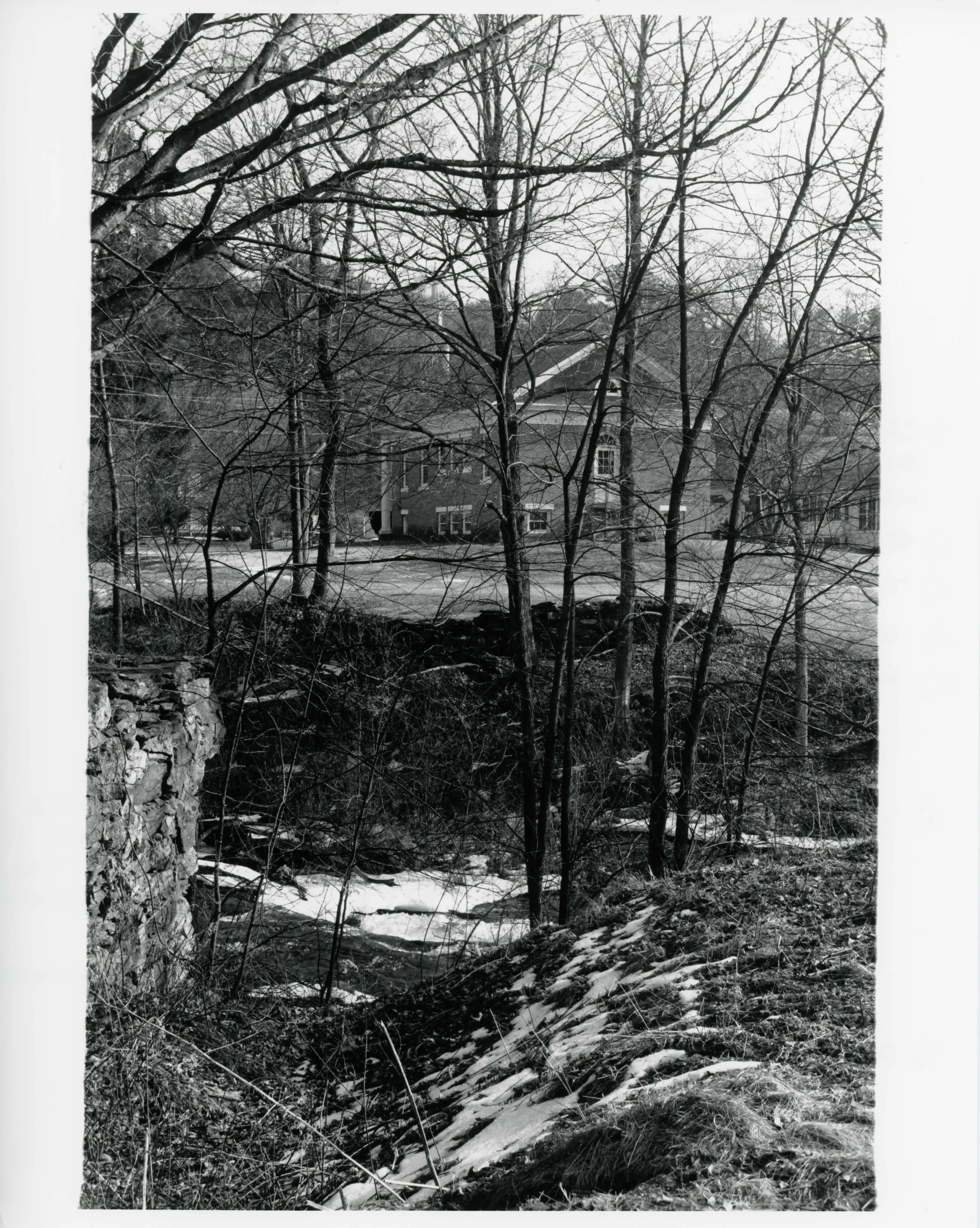
Looking east across the Konkapot River, from River Rd.
Looking east across the Konkapot River, from River Rd.Photo: Theodore Atkinson, 4 Jan 1990. From the National Register nomination, National Archives.
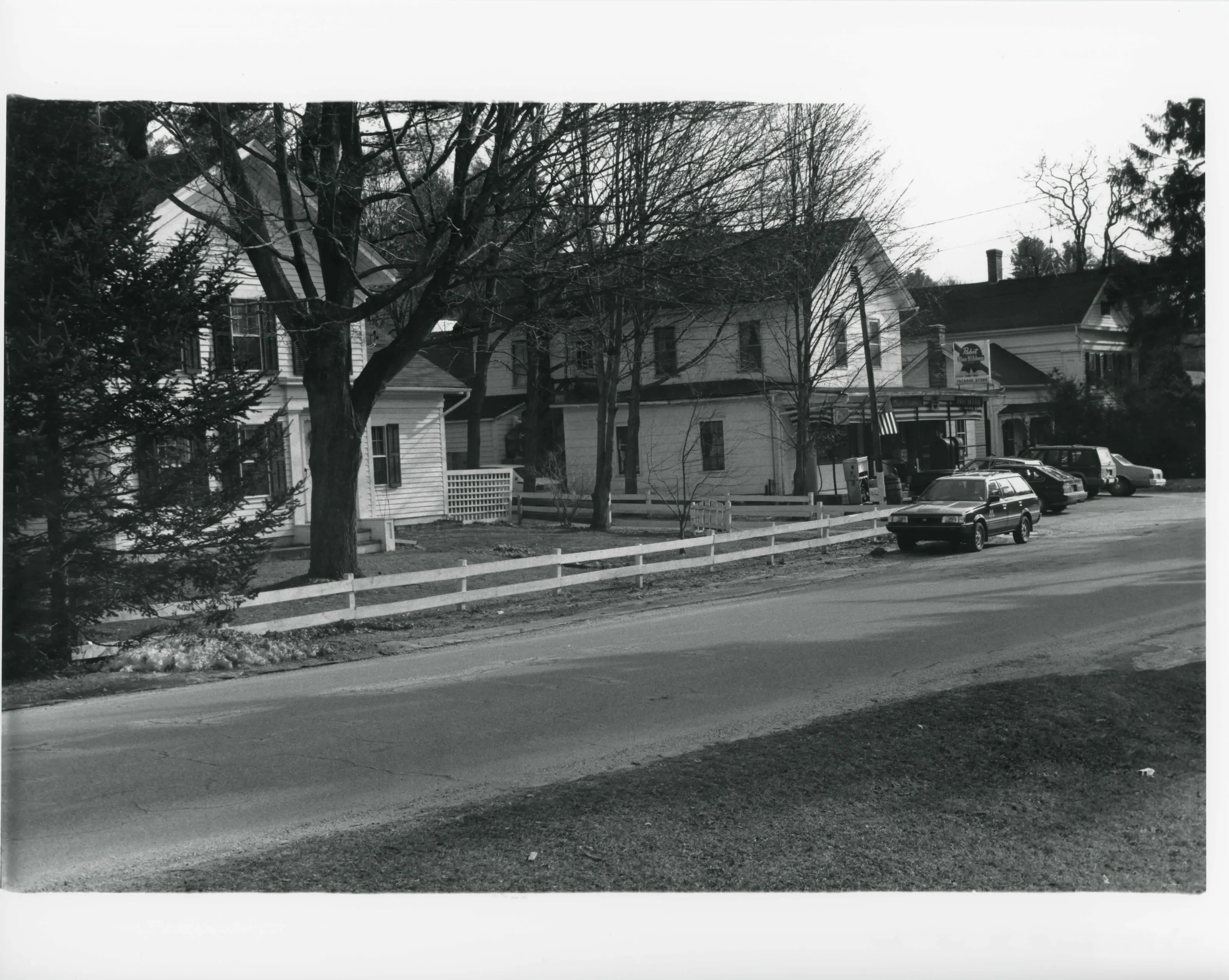
Three houses on east side of Main St. in center of village; l. to r.: Sporn house, Mill River General Store, Lehman house
Three houses on east side of Main St. in center of village; l. to r.: Sporn house, Mill River General Store, Lehman housePhoto: Theodore Atkinson, 4 Jan 1990. From the National Register nomination, National Archives.
Site of 19th cent. 'Upper Paper Mill' of Crosby & Robbins on the Konkapot River; looks north up river from bridge on Hayes Hill Road
Site of 19th cent. 'Upper Paper Mill' of Crosby & Robbins on the Konkapot River; looks north up river from bridge on Hayes Hill RoadPhoto: Theodore Atkinson, 4 Jan 1990. From the National Register nomination, National Archives.
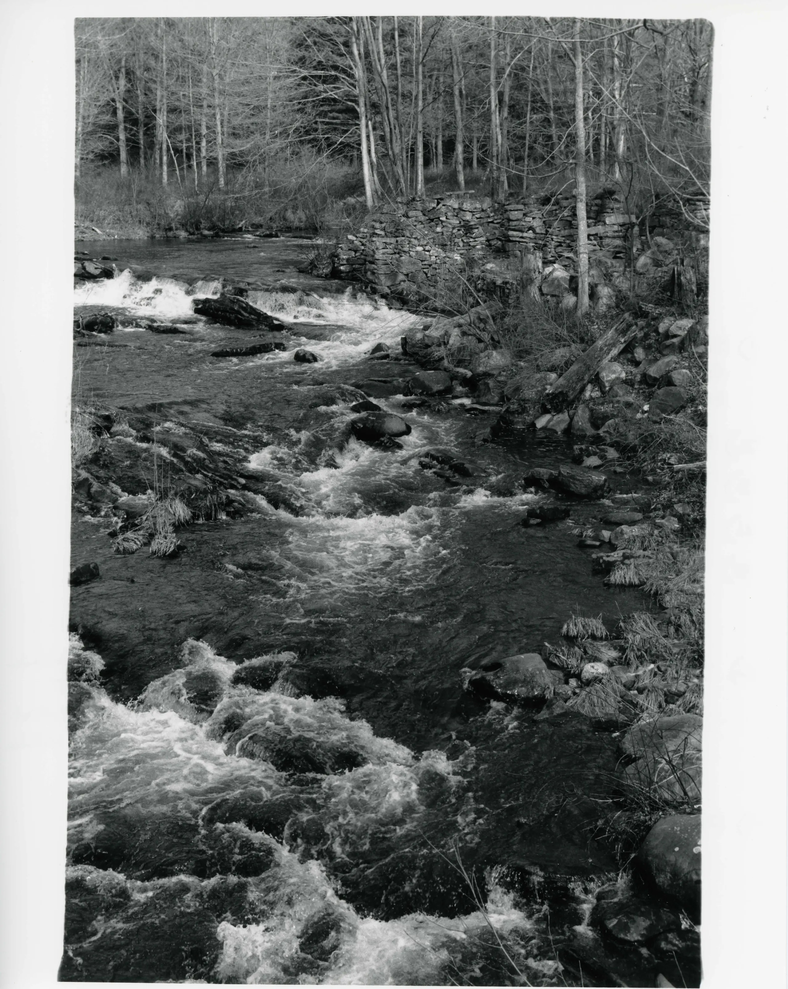
1742 site of Nahum Ward gristmill, east side of Konkapot River; looks up stream and north from bridge on Mill River - Great Barrington Road
1742 site of Nahum Ward gristmill, east side of Konkapot River; looks up stream and north from bridge on Mill River - Great Barrington RoadPhoto: Theodore Atkinson, 4 Jan 1990. From the National Register nomination, National Archives.
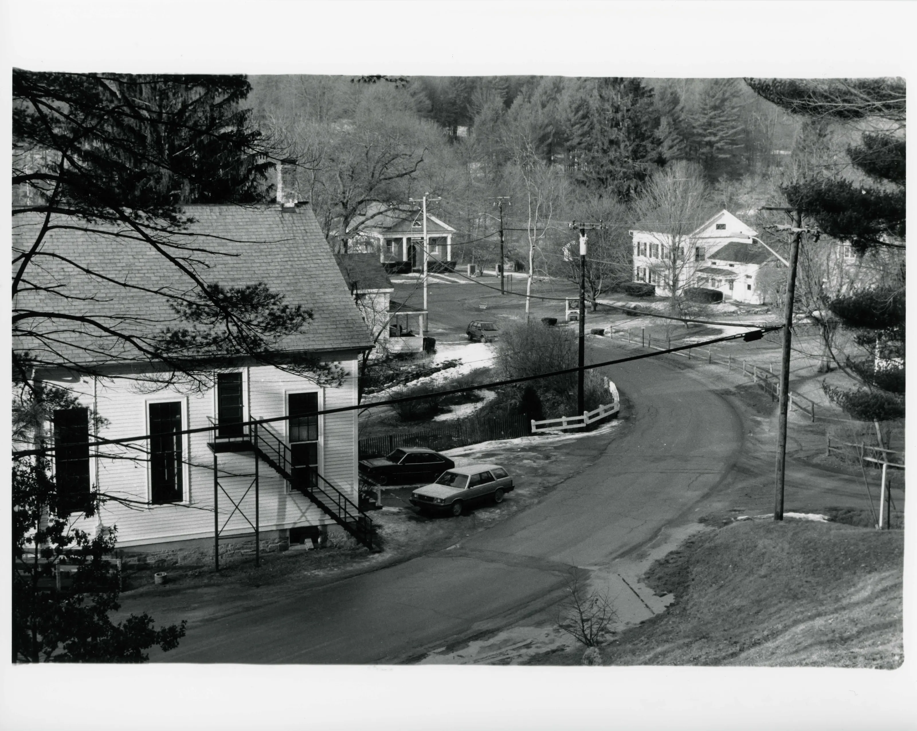
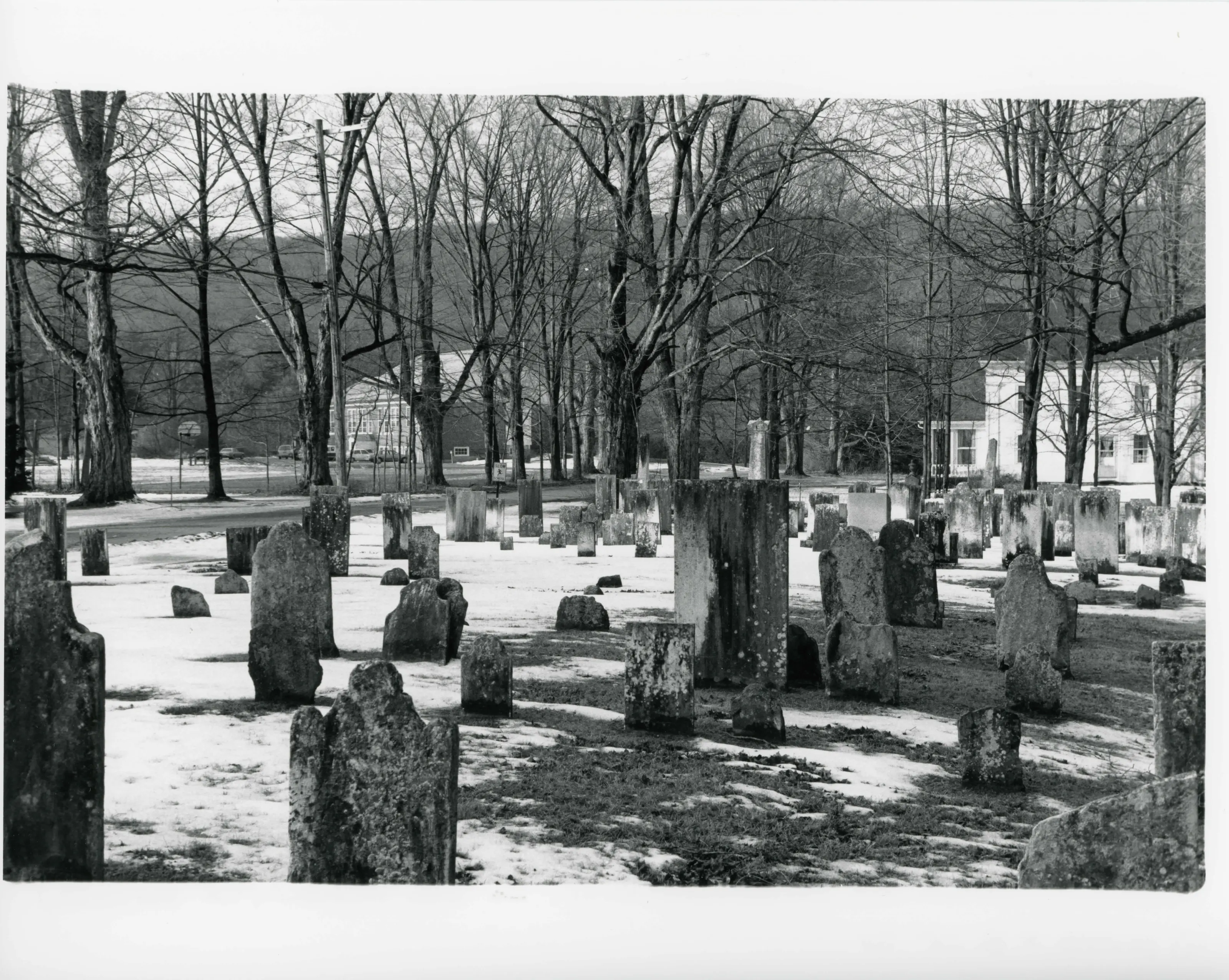
View from Old Mill River Cemetery; cemetery in foreground, field property on right, New Marlborough Central School on left
View from Old Mill River Cemetery; cemetery in foreground, field property on right, New Marlborough Central School on leftPhoto: Theodore Atkinson, 4 Jan 1990. From the National Register nomination, National Archives.
The pin marks the center of the listed area as the Park Service maps it, on the outline of New Marlborough.
Sources, rights and limits
  • Listing facts. National Park Service, National Register of Historic Places spatial data, queried 6 November 2026: type, year listed, landmark status, map location. U.S. government work, public domain.
  • Nomination text and areas of significance. National Archives catalog record 63794372, “Massachusetts SP Mill River Historic District”. National Register nomination forms are U.S. government records and public domain. The quoted text is the catalog’s text layer (machine reading of the scan, 2025-07-29), not a transcription.
  • Photographs. Photographs are reproduced from the nomination file at the National Archives with the photographer’s credit as typed on the print; rights may remain with the photographer. Write to hello@parcenomics.com to have one removed.
  • Location line. Address as in the Park Service layer.
  • Outline. Town boundary from the Commonwealth’s town layer, generalized. Not a survey.