Nantucket · National Register
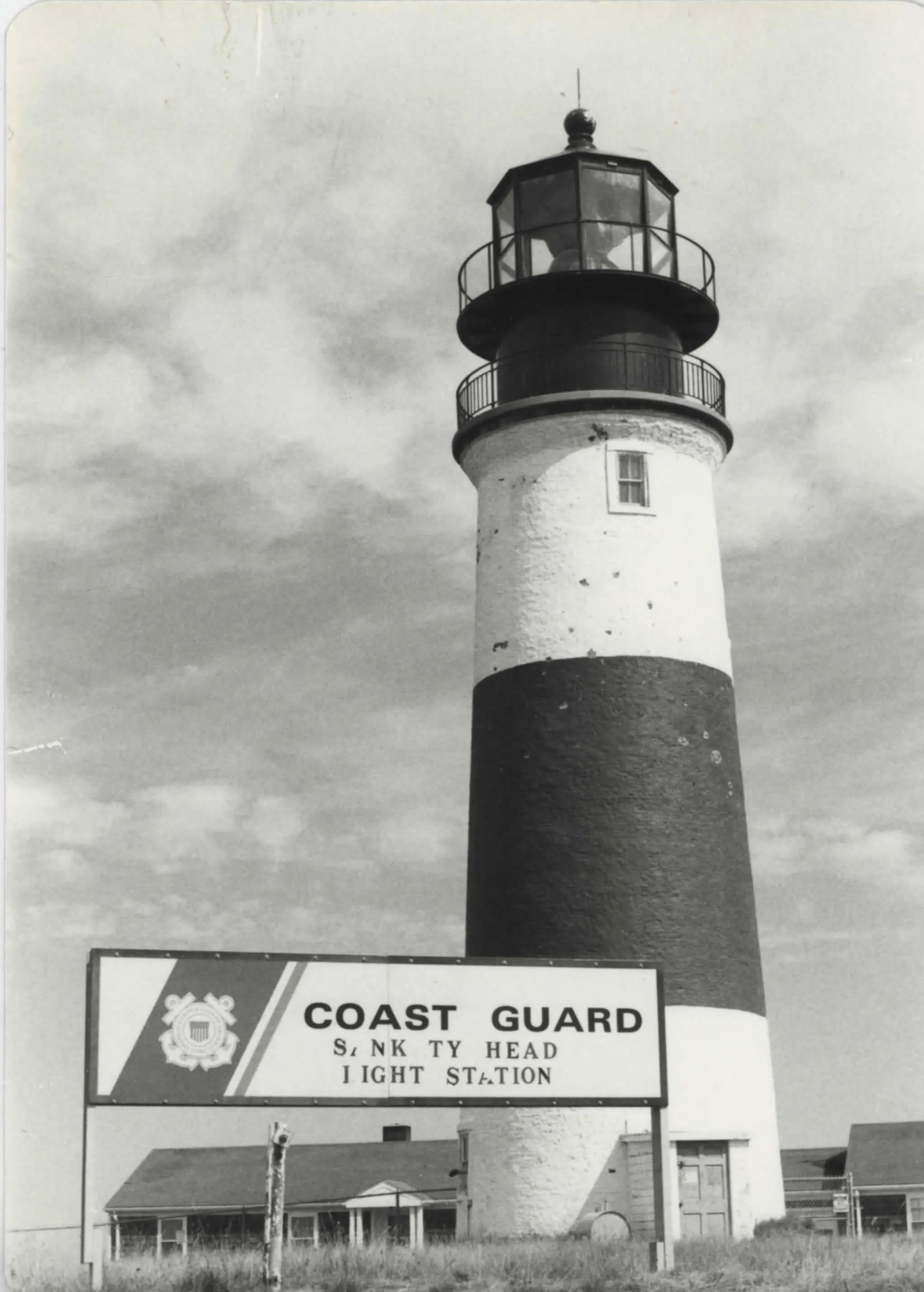
Sankaty Head Light
Structure · listed 1987
- Type
- Structure
- Town
- Nantucket
- Listed
- 1987
- Multiple property listing
- Lighthouses of Massachusetts TR
- Location
- Sankaty Head, Nantucket Island
- Areas of significance
- Engineering; Transportation; Maritime History
- Reference number
- 87002028
About this listing
Lighthouse station on Sankaty Head, about a mile north of Siasconset, with a tower (1849) and oil house (1887) as contributing elements. The light stands 160 feet above the water and guards the Southern Shoals.
- Built
- 1849 (tower)
The light sits 160 feet above the water near the edge of a cliff and is nine miles from Nantucket Light.
“a tower (1849), oil house (1887), two 1960 ranch-style houses, and a helicopter pad make up the station”
National Register nomination
Summary paraphrased from the nomination text; the form is linked below.
The scanned form’s text could not be separated into its description and significance sections reliably, so those two sections are not quoted here. The full form is linked below.
History of NantucketFamily names in NantucketNational Archives recordNomination form (PDF, 130 MB)Search MACRIS
Nearby listings in Nantucket
Sources, rights and limits
- Listing facts. National Park Service, National Register of Historic Places spatial data, queried 6 November 2026: type, year listed, landmark status, map location. U.S. government work, public domain.
- Nomination text and areas of significance. National Archives catalog record 63792341, “Massachusetts MPS Sankaty Head Light”. National Register nomination forms are U.S. government records and public domain. The quoted text is the catalog’s text layer (machine reading of the scan, 2025-07-29), not a transcription.
- Photographs. Photographs are reproduced from the nomination file at the National Archives with the photographer’s credit as typed on the print; rights may remain with the photographer. Write to hello@parcenomics.com to have one removed.
- Location line. Address as in the Park Service layer.
- Outline. Town boundary from the Commonwealth’s town layer, generalized. Not a survey.