1 · Nature
9
state-listed species on record
5 of the 9 have been recorded since 2001. Billerica has 12, Chelmsford 14 and Dracut 10; the other 2 range from 13 to 15; Lowell is 264th most of 351.
Middlesex County · Lowell
City · 118,368 residents · 13.6 square miles
State aid covers 54.6% of what Lowell spends, 6th highest of 346; Billerica is at 14.5% and Chelmsford 13.9%.
For five years I served on a select board, including as its chair. Every budget season brought the same question: what do we appropriate, and how much should we raise? It struck me that the data needed to make good decisions, and how it all related, was often lacking. I set out to create a space where, for every town in the Commonwealth, we could weave these threads together into a narrative that informs good decision-making. That’s what Massanomics provides: not just information on budgets, land, water, climate and disasters, but a coherent story drawn from the many public sources available.
For Lowell, that means four city-owned bridges rated poor, $7.9 million in earmarks placed in the city over ten budgets ($66.99 per resident) and 43 National Register listings.
Patrick White, former Chair, Stockbridge Select Board
Municipal Focus
Published November 13, 2026
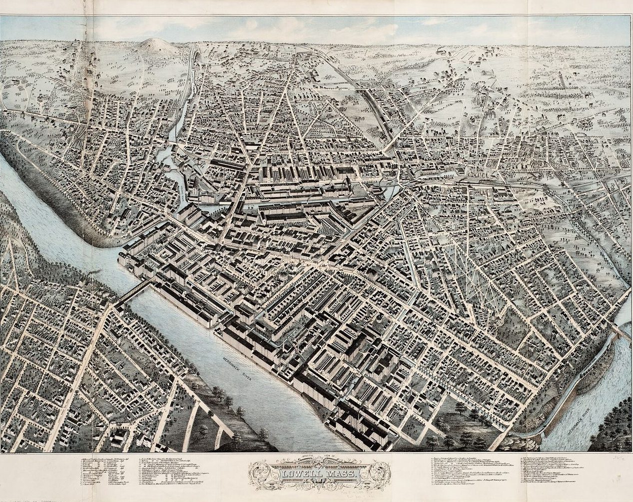
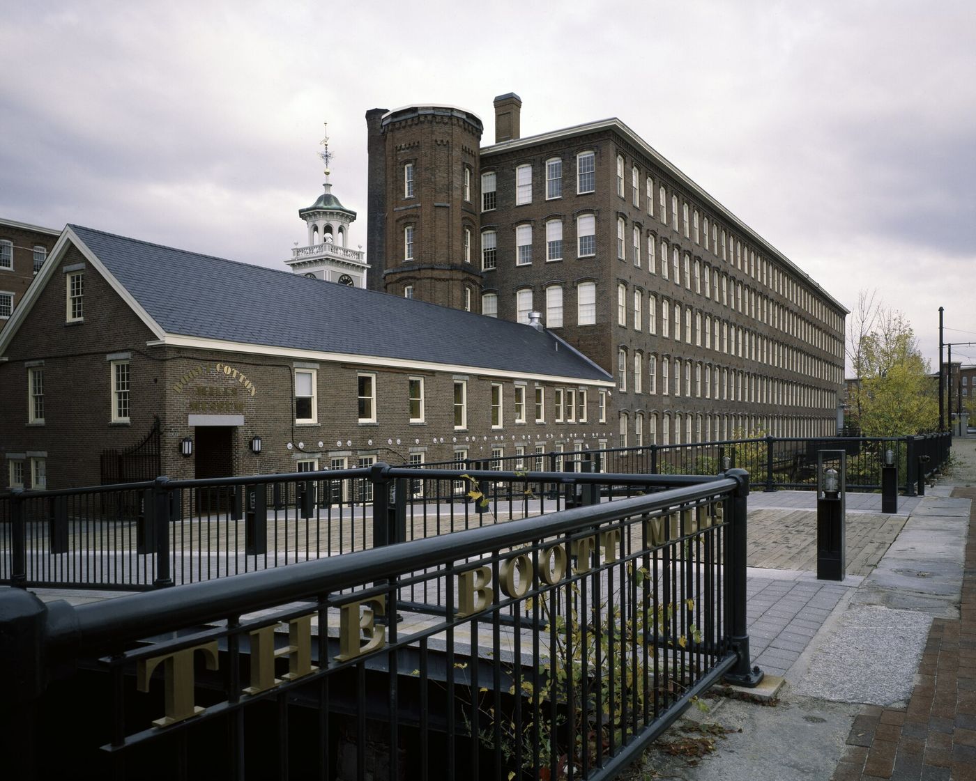
Lowell has had to invent itself twice. In the 1820s Boston financiers turned a farming village at the Pawtucket Falls of the Merrimack into America’s first successful planned industrial city. A century later the mills left, and Lowell spent the next fifty years working out what to be instead. The answer, in the end, was the mills themselves.
The city is named for Francis Cabot Lowell, a Boston merchant who toured British textile mills in 1810 and came home to build a power loom with the mechanic Paul Moody. He died in 1817. Nine years later a mill town carved from Chelmsford took his name. In ten years its population grew from 2,500 to about 18,000, and in 1836 Lowell became the third city in Massachusetts, after Boston and Salem.
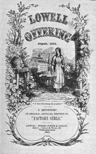
Irish laborers dug the canals. Young women from New England farms ran the looms and lived in company boardinghouses beside the mills; from 1840 to 1845 they wrote and published their own magazine, the Lowell Offering.
Then the money moved south. Rather than modernize, the owners used Lowell’s profits to build newer mills in the Southern states. A wave of closings came in the mid-1920s, and by the mid-1930s only three of the city’s first large mills, the Merrimack, the Lawrence and the Boott, were still running. The Second World War brought the mills a few good years. The Boott closed in 1956 and the Merrimack in 1958, the last of the original mills.
The turn began in the schools. Patrick Mogan, an assistant superintendent, argued in the 1960s that Lowell’s mills, canals and immigrant neighborhoods were not blight to be cleared but the soul of the city and the key to its recovery. Paul Tsongas, a Lowell native, carried the idea to Congress, and on June 5, 1978, President Carter signed the law creating Lowell National Historical Park, a national park about work, run in partnership with the city and the state. The park and its partners have since rehabilitated almost all of the 5.3 million square feet of historic mill space.
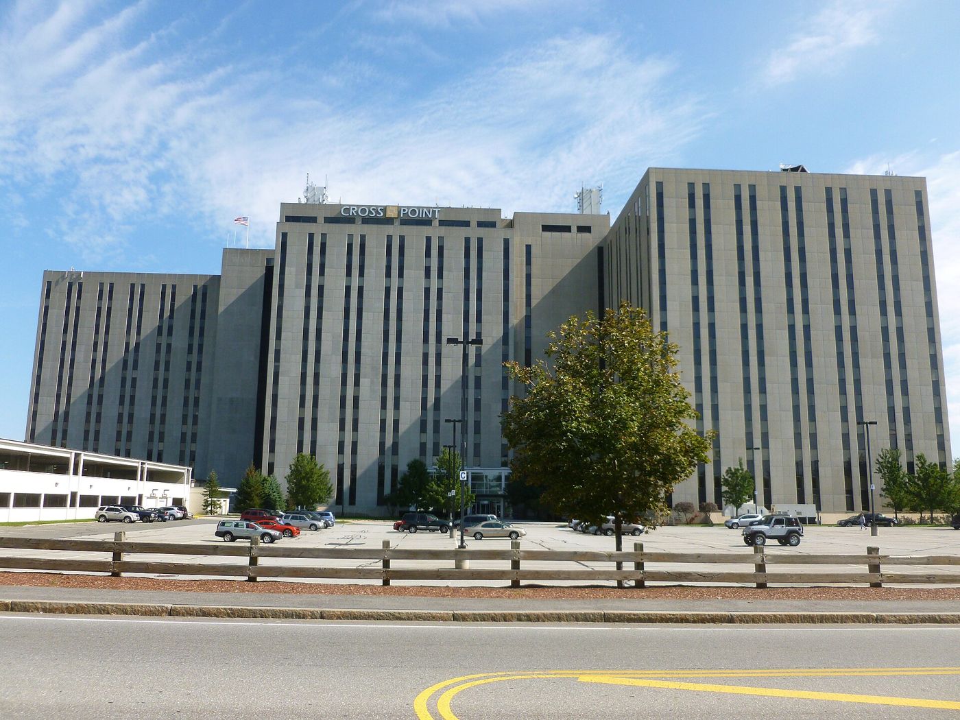
The second engine was a computer company. Wang Laboratories moved its headquarters to Lowell in 1976. At its peak in the 1980s it had $3 billion in annual revenue and some 33,000 employees, one of the leading companies of the “Massachusetts Miracle,” and its three connected towers rose on Chelmsford Street. Its word-processing revenue fell steeply in the mid-1980s. Wang filed for bankruptcy in August 1992, and its lenders foreclosed on the towers in 1994. They stand today as Cross Point.
Lowell came back anyway, and this time not on one employer. Jobs in the city grew 16.6% from 2008 to 2018, and the population grew from 106,519 at the 2010 census to 115,554 in 2020, the fifth-largest city in the state. UKG, the workforce-software company once called Kronos, has one of its two headquarters here; Lowell General Hospital, UKG and IBM are among the city’s largest employers. Interstate 495 runs through the city, and the commuter rail runs to Boston.
The university is the anchor. UMass Lowell grew out of the Lowell Textile School of the 1890s; its engineering college is named for James B. Francis, the hydraulic engineer who began his career in Lowell in 1834. In 2025 it became a Carnegie R1 research university, with research spending above $120 million a year. Its Lowell Innovation Network Corridor runs from campus into downtown, where Draper is building a 111,000-square-foot microelectronics center in the Hamilton Canal Innovation District, 15 acres of former mill land between downtown and the train station.
Since the 1980s, refugees from Cambodia and their families have made Lowell home to the second-largest Cambodian American community in the country, and in 2022 the city council chose Sokhary Chau as mayor, the first Cambodian American mayor in the United States. Lowell is run by a city manager under its 1942 Plan E charter; since 2021, eight of its eleven councilors are elected by district.
The budget still leans on the state. In FY2026 Lowell plans to spend $568.5 million before enterprise accounts; state aid pays 53% of it, led by $292.9 million in Chapter 70 school aid, and property tax 33%. On the Fairness Index, which weighs what a city or town receives against its size, need and burden, Lowell scores 70 for all state aid, 12th of 351.
Patrick Mogan’s bet was that the mills were worth more standing than torn down. Nearly fifty years after the park opened, Lowell is still collecting on it.
Live in Lowell or know it well? Send a photo to hello@parcenomics.com with your name and where you took it. By sending one, you confirm you took it and allow Massanomics to publish it with your credit.
Sources: Encyclopaedia Britannica, Lowell; Wikipedia, History of Lowell, Massachusetts; Wikipedia, Lowell, Massachusetts; National Parks Traveler, Park History: Lowell National Historical Park; Lowell: The Mill City (Arcadia); National Park Service, The Mill Girls of Lowell; National Park Service, Women’s History in Lowell; National Park Service, Lowell National Historical Park; National Park Service, Decline and Recovery; National Park Service, Making the Park; National Park Service, Rebirth of Lowell; National Park Service, Lowell National Historical Park Foundation Document; Richard Howe, July 21, 2024 (Wang Laboratories); Wikipedia, Wang Laboratories; Pioneer Institute, Economic Revitalization and Reinvention in Lowell, 1998–2018; City of Lowell, Top Employers; Built In, UKG; UMass Lowell, Francis College of Engineering history; UMass Lowell, R1 announcement, February 13, 2025; Construction Equipment Guide, Draper IMPACT Center; City of Lowell, Hamilton Canal Innovation District Plan; Wikipedia, Cambodian Americans; CommonWealth Beacon, Inching toward acceptance; WBSM, Lowell’s Cambodian American mayor; Richard Howe, Lowell adopts Plan E, July 9 and 16, 2023; Division of Local Services, FY2026 revenue by source and cherry sheet.
Nature and money, in turn
1 · Nature
9
state-listed species on record
5 of the 9 have been recorded since 2001. Billerica has 12, Chelmsford 14 and Dracut 10; the other 2 range from 13 to 15; Lowell is 264th most of 351.
2 · Money
$7.9M
in local earmarks, ten state budgets
In ten enacted state budgets, FY2017 to FY2026, that is $66.99 per resident, 119th of 351. Billerica had $904,000, Chelmsford $1.5 million, Dracut $1.7 million and Tewksbury $1.9 million placed in them; the other 1 range from $555,000 to $555,000.
3 · Nature
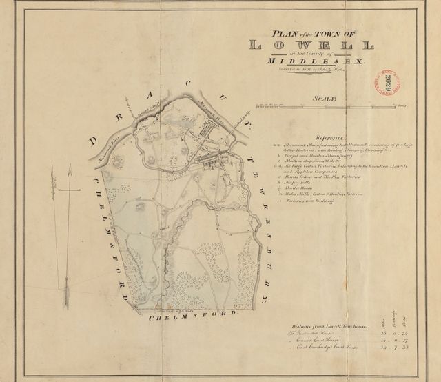
Woodland was 17% of the town in 1830 and is 5% now.
The 1830 figure is traced from the town’s plan, which under-records small woodlots; 5% is DCR’s 2021 satellite estimate.
Forest, 1971 to 1999: Lowell −30.4%, Billerica −30.7%, Chelmsford −27.2% and Dracut −23.5%; the other 2 range from −26.4% to −21.3%. Lowell is 338th of 351 (1 = most gained).
4 · Money
54.6%
of spending covered by state aid
The median town’s share is 11.5%. Billerica is at 14.5%, Chelmsford 13.9% and Dracut 32.3%; the other 2 range from 11.9% to 18.2%; Lowell’s is 6th highest of 346.
FY2025. Chapter 70 school aid paid to the regional district is outside this share.
5 · Nature
11%
of the land is core habitat
That is 963 acres, 281st of 351 by share of land; the median town has 25%. Billerica has 5%, Chelmsford 4% and Dracut 19%; the other 2 range from 6% to 30%.
Lowell is a city of 118,368 people on 13.6 square miles of Middlesex County, 8,697 to the square mile, among the most densely settled fifth of the state. Median household income is $79,000, below the median town’s $114,000, and 17% of residents are below the poverty line. State aid is a large part of its budget: it covered 54.6% of general-fund spending in FY2025, against 11.5% for the median town. On the Fairness Index it scores 70 for all state aid and 54 for discretionary money — above its share on all state aid, about its share on the money legislators and agencies choose to give. Its Land and Water Index is 12, 335th of 351. On the strong side: formula aid came to $24,024 per resident over ten years, 12th of 351; its Fairness score of 70 for all state aid is among the higher in the state (12th of 351); Chapter 70 aid per pupil, after inflation, has risen 27% since FY2017.
Where it comes up short: 100% of its assessed lake acres and river miles are on the state’s impaired list — mercury in fish, bacteria; it lost 30% of its 1971 forest by 1999, more than nine towns in ten; the forest now covers about 13% of the city, down from the 17% the surveyors drew in 1830.
The openings are specific: 598 acres of core habitat, 62% of it, sit on land with no protection, the acreage state and land-trust programs exist to fund; its ten nearest peers’ median earmark per resident is $102 against its own $66.99, so towns like it do receive earmarks. The risks are equally specific: four of its bridges are rated poor and it owns one high- or significant-hazard dam.
The money
Lowell’s town government and school districts received $2.84 billion in formula aid and $45.5 million in competitive grants over ten years.
Fairness Index · all state aid
70 / 100
12th of 351
Fairness Index · discretionary money
54 / 100
175th of 351
The land
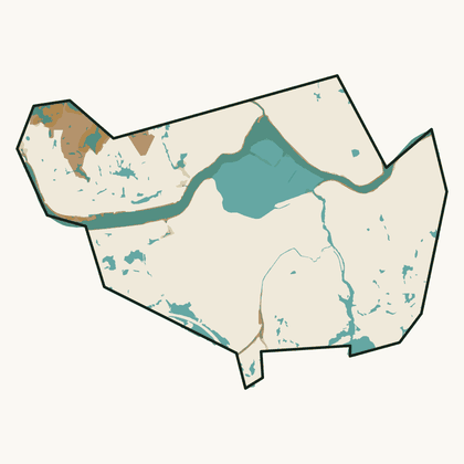
Lowell has 963 acres of mapped core habitat, 11% of its land area; 598 of those acres are outside any protected land.
Habitat, forest and water ›To pass along
Nature
Lowell has 9 state-listed species on record, 264th most of 351; Billerica has 12 and Chelmsford 14.
Money
Lowell had $7.9 million in local earmarks placed in it over ten enacted state budgets, $66.99 per resident, 119th of 351; Billerica had $904,000 and Chelmsford $1.5 million.
History
Lowell’s town plan of 1830 is online at Digital Commonwealth, as are those of Billerica and Chelmsford; 291 of 351 towns have one.
This is your town, your city, the place you will spend these days of your life. The quality of that life depends on good decisions. I am a lifelong resident of Massachusetts and care deeply about this place. If we can be of service, write hello@parcenomics.com, or ask me to present to your board.
Sources: MassWildlife NHESP rare-species records by town, to 2025; MassWildlife BioMap 2022; MassGIS land use 1971–1999, USGS land cover 2001–2023 and DCR forest 2021; 1830 town plans, Massachusetts Archives, via Digital Commonwealth; Comptroller, Division of Local Services and DESE records through FY2026. Land layers as published 1 November 2026; money figures as built 3 November 2026. Every figure links to Lowell’s money page or Lowell’s land page.