1 · Nature
38
state-listed species on record
18 of the 38 have been recorded since 2001. The nearest towns are Aquinnah (33) and Chilmark (55). Gosnold is 43rd most of 351.
Dukes County · Gosnold
Town · 31 residents · 13.2 square miles
Gosnold scores 82 on the Fairness Index for all state aid, 1st of 351 (1 = most above its share). The nearest towns are Aquinnah (38) and Chilmark (33).
For five years I served on a select board, including as its chair. Every budget season brought the same question: what do we appropriate, and how much should we raise? It struck me that the data needed to make good decisions, and how it all related, was often lacking. I set out to create a space where, for every town in the Commonwealth, we could weave these threads together into a narrative that informs good decision-making. That’s what Massanomics provides: not just information on budgets, land, water, climate and disasters, but a coherent story drawn from the many public sources available.
For Gosnold, that means relative sea level up 1.24 inches a decade at the Woods Hole tide gauge, no earmarks placed in town in ten budgets and 71% core habitat.
Patrick White, former Chair, Stockbridge Select Board
Municipal Focus
Published November 13, 2026
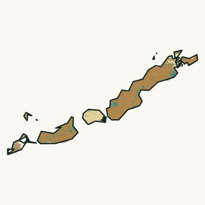
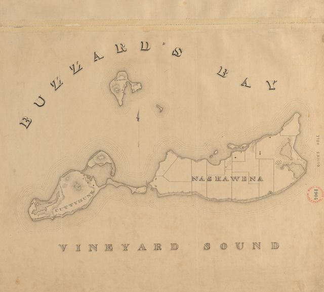
Gosnold is the smallest town in Massachusetts: 70 people at the 2020 census and, by the town’s own count, about 20 year-round on Cuttyhunk and a few more on Naushon and Nashawena. It is also the longest. The town is nine islands, the Elizabeth Islands, strung southwest from Woods Hole between Buzzards Bay and Vineyard Sound. Most of its people live in the village of Cuttyhunk, on the outermost island. The state counted 97 registered voters in February 2025. Most of the land is not the town’s to plan: trusts own 93% of it, and the Naushon Trust alone holds 62%.
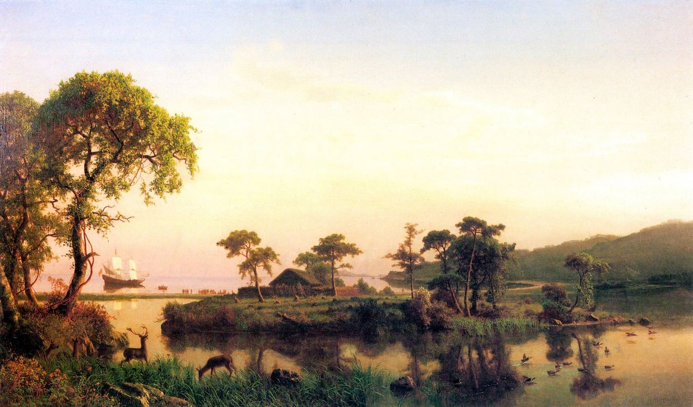
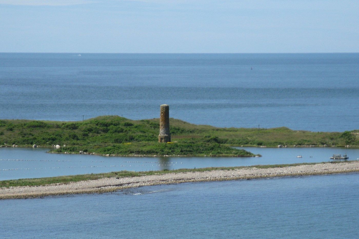
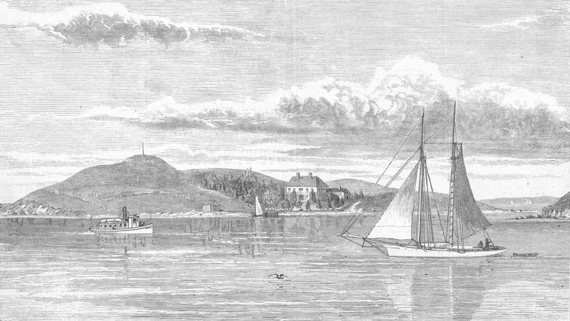
The name is borrowed from Bartholomew Gosnold, an English captain who came for sassafras in 1602. His men built a small fort on an islet in Cuttyhunk’s pond and stayed a few weeks, arguably the first English settlement in New England, eighteen years before Plymouth. Five years later Gosnold helped found Jamestown, and died there. A stone tower, dedicated in 1903, marks the islet. The islands were part of Chilmark until Gosnold was incorporated in 1864.
Gosnold governs itself by open town meeting. Its three-member select board is also the planning board and the board of health. The town’s website lists nine boards, from the zoning board of appeals to the harbor management committee, with 40 seats among them. Twenty-four people fill those seats, and four of them sit on four boards each. In 2021 the state’s Division of Local Services counted 14 year-round employees. One held six roles: fire and EMS chief, electric relief, highway supervisor, zoning board chair, finance committee member and shellfish warden. The one-room schoolhouse, built in 1873, has had years with no pupils.
The FY2026 budget is $2.2 million before enterprise accounts. Property tax raises $905,574 of it, 41%. Local receipts bring in $815,000, 37%; the state’s 2021 review found most of them come from the harbor and wharf. State aid is $40,740, under 2%. The tax rate, $3.16 per $1,000 of value, is the fifth-lowest of 351, and 86% of homes are seasonal, the highest share in the state.
They credit the phrase “You can’t get there from here” as a classic New England piece of folk humor. Yet when a Nor’easter bears down on the islands, it couldn’t be more true for the good folks of Gosnold.
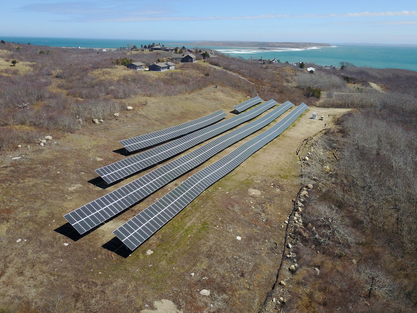
The town makes its own electricity, through a town-owned light plant. Since 2017 solar panels and a battery bank have supplied about half of Cuttyhunk’s power; the diesel generators start when they are needed. Fuel was harder. When the island’s underground fuel tanks came out, islanders and visitors carried their own gas cans to and from the mainland for three years. In January 2023, about ten voters at a special town meeting approved borrowing $500,000 for two 6,000-gallon tanks. The state added $785,398 in coastal resilience grants to design and build them above ground, with the rising sea in mind.
Just north of Cuttyhunk lies Penikese, the state’s island. In 1873 Louis Agassiz opened a school of natural history there, where students were to study nature rather than books; two of them went on to found the Marine Biological Laboratory at Woods Hole. In 1904, after mainland towns objected to the sites first chosen, the state bought Penikese for $25,000 for a leprosy hospital. It closed in 1921, and its thirteen patients were moved to the federal hospital in Carville, Louisiana. Penikese is now a bird sanctuary.
No local earmark reached Gosnold in ten state budgets. Competitive grants did: $6.6 million over ten years, 2.7 times what its size, need and institutions predict. The largest, $1.4 million in 2020, helped the town and the Buzzards Bay Coalition buy and permanently protect 67 acres on Cuttyhunk. On Question 7, Gosnold cast 48 votes: 22 yes, 26 no.
Live in Gosnold or know it well? Send a photo to hello@parcenomics.com with your name and where you took it. By sending one, you confirm you took it and allow Massanomics to publish it with your credit.
Sources: U.S. Census Bureau, 2020 Census; Town of Gosnold, About and Boards & Committees pages (members as listed, November 13, 2026); Secretary of the Commonwealth, enrollment breakdown as of February 1, 2025; Division of Local Services, Town of Gosnold Financial Management Review, April 2021; Division of Local Services, FY2026 revenue by source and tax rates; seasonal homes: American Community Survey 2020–24; Encyclopedia Virginia, Bartholomew Gosnold; Old Dartmouth Historical Sketch No. 4, New Bedford Whaling Museum; Dukes County, Town of Gosnold; New Bedford Free Public Library, Dedication of Gosnold Monument, 1903, via Digital Commonwealth; Government Technology, Cuttyhunk electric supply goes half-solar; Massachusetts Municipal Association, solar and battery system helps power Gosnold island, 2017; WBUR, On Cuttyhunk Island, a one-room schoolhouse, 2018; Vineyard Gazette, Cuttyhunk Approves Funding for New Fuel Farm, January 31, 2023; Executive Office of Energy and Environmental Affairs, Coastal Zone Management and Municipal Vulnerability Preparedness grant records; Penikese Island School, History; Martha’s Vineyard Times, The Master of Penikese Island, January 26, 2016; Question 7: Associated Press counts as published by WBUR, as on the statewide finding; population elsewhere on this page is the Census Bureau’s 2020–24 survey estimate.
Nature and money, in turn
1 · Nature
38
state-listed species on record
18 of the 38 have been recorded since 2001. The nearest towns are Aquinnah (33) and Chilmark (55). Gosnold is 43rd most of 351.
2 · Money
$0
in local earmarks, ten state budgets
In ten enacted state budgets, FY2017 to FY2026, Gosnold is one of 35 of the 351 municipalities with no local earmark. The nearest towns: Aquinnah $100,000 and Chilmark none.
3 · Nature
Woodland was 27% of the town in 1830 and is 44% now.
The 1830 figure is traced from the town’s plan, which under-records small woodlots; 44% is DCR’s 2021 satellite estimate.
Forest, 1971 to 1999: Gosnold +0.1%. The nearest towns are Aquinnah (−12.1%) and Chilmark (−11.0%). Gosnold is 7th of 351 (1 = most gained).
4 · Money
no figure
state aid share of spending
Gosnold reports no general-fund spending figure to the state, so no share of spending is shown. Its FY2025 state aid was $41,000; the median town’s aid covers 11.5% of spending.
5 · Nature
71%
of the land is core habitat
That is 5,973 acres, 10th of 351 by share of land; the median town has 25%. The nearest towns are Aquinnah (50%) and Chilmark (38%).
Gosnold is a town of 31 people on 13.2 square miles of Dukes County, 2 to the square mile, among the least densely settled fifth of the state. On the Fairness Index it scores 82 for all state aid and 96 for discretionary money — above its share on both. Its Land and Water Index is 73, 68th of 351. 86% of its housing units are seasonal. On the strong side: its Fairness score of 96 for discretionary money is among the higher in the state (17th of 351); formula aid came to $32,727 per resident over ten years, 3rd of 351; it kept essentially all of its 1971 forest through 1999, more than nine towns in ten; the forest now covers about 38% of the town, up from the 27% the surveyors drew in 1830.
Where it comes up short: in ten enacted state budgets no earmark was placed in it on any of the three measures.
The openings are specific: 4,096 acres of core habitat, 69% of it, sit on land with no protection, the acreage state and land-trust programs exist to fund; $99,000 of its Chapter 90 road money is apportioned and not yet drawn. The risks are equally specific: beech leaf disease has been mapped in town by the aerial survey since 2019.
The money
Gosnold’s town government and school districts received $1 million in formula aid and $6.6 million in competitive grants over ten years.
Fairness Index · all state aid
82 / 100
1st of 351
Fairness Index · discretionary money
96 / 100
17th of 351
The land
Gosnold has 5,973 acres of mapped core habitat, 71% of its land area; 4,096 of those acres are outside any protected land.
Habitat, forest and water ›To pass along
Nature
Gosnold has 38 state-listed species on record, 43rd most of 351. The nearest towns are Aquinnah (33) and Chilmark (55).
Money
No local earmark was placed in Gosnold in ten enacted state budgets, one of 35 of the 351 municipalities with none. The nearest towns are Aquinnah ($100,000) and Chilmark (none).
History
Gosnold’s town plan of 1830 is online at Digital Commonwealth, as are those of Chilmark; 291 of 351 towns have one.
This is your town, your city, the place you will spend these days of your life. The quality of that life depends on good decisions. I am a lifelong resident of Massachusetts and care deeply about this place. If we can be of service, write hello@parcenomics.com, or ask me to present to your board.
Sources: MassWildlife NHESP rare-species records by town, to 2025; MassWildlife BioMap 2022; MassGIS land use 1971–1999, USGS land cover 2001–2023 and DCR forest 2021; 1830 town plans, Massachusetts Archives, via Digital Commonwealth; Comptroller, Division of Local Services and DESE records through FY2026. Land layers as published 1 November 2026; money figures as built 3 November 2026. Every figure links to Gosnold’s money page or Gosnold’s land page.